Y14A Wickenburg, AZ, USA - Earthquake Result Viewer
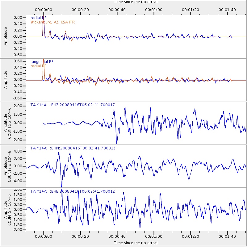
Earthquake location: Andreanof Islands, Aleutian Is.
Earthquake latitude/longitude: 51.9/-179.2
Earthquake time(UTC): 2008/04/16 (107) 05:54:19 GMT
Earthquake Depth: 13 km
Earthquake Magnitude: 6.1 MB, 6.5 MS, 6.6 MW, 6.6 MW
Earthquake Catalog/Contributor: WHDF/NEIC
Network: TA USArray Transportable Network (new EarthScope stations)
Station: Y14A Wickenburg, AZ, USA
Lat/Lon: 33.94 N/113.00 W
Elevation: 731 m
Distance: 49.9 deg
Az: 83.933 deg
Baz: 312.144 deg
Ray Param: 0.06841064
Estimated Moho Depth: 21.75 km
Estimated Crust Vp/Vs: 1.95
Assumed Crust Vp: 6.264 km/s
Estimated Crust Vs: 3.212 km/s
Estimated Crust Poisson's Ratio: 0.32
Radial Match: 91.98756 %
Radial Bump: 400
Transverse Match: 80.2915 %
Transverse Bump: 400
SOD ConfigId: 2504
Insert Time: 2010-03-07 05:17:21.338 +0000
GWidth: 2.5
Max Bumps: 400
Tol: 0.001

Signal To Noise

ChannelStoNSTALTA
TA:Y14A: :BHN:20080416T06:02:41.70001Z3.30095865.8036E-71.7581559E-7
TA:Y14A: :BHE:20080416T06:02:41.70001Z1.84289872.888487E-71.5673608E-7
TA:Y14A: :BHZ:20080416T06:02:41.70001Z2.24084852.3245168E-71.03733775E-7
Arrivals
Ps3.5 SECOND
PpPs9.7 SECOND
PsPs/PpSs13 SECOND