You are here: Home > Network List > TA - USArray Transportable Network (new EarthScope stations) Stations List
> Station Y14A Wickenburg, AZ, USA > Earthquake Result Viewer
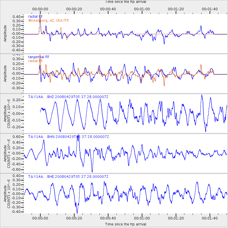
Y14A Wickenburg, AZ, USA - Earthquake Result Viewer
*The percent match for this event was below the threshold and hence no stack was calculated.
| Earthquake location: |
Hokkaido, Japan Region |
| Earthquake latitude/longitude: |
41.5/142.0 |
| Earthquake time(UTC): |
2008/04/29 (120) 05:26:04 GMT |
| Earthquake Depth: |
47 km |
| Earthquake Magnitude: |
5.5 MB, 5.2 MS, 5.8 MW, 5.8 MW |
| Earthquake Catalog/Contributor: |
WHDF/NEIC |
|
| Network: |
TA USArray Transportable Network (new EarthScope stations) |
| Station: |
Y14A Wickenburg, AZ, USA |
| Lat/Lon: |
33.94 N/113.00 W |
| Elevation: |
731 m |
|
| Distance: |
78.2 deg |
| Az: |
55.147 deg |
| Baz: |
312.099 deg |
| Ray Param: |
$rayparam |
*The percent match for this event was below the threshold and hence was not used in the summary stack. |
|
| Radial Match: |
52.875435 % |
| Radial Bump: |
383 |
| Transverse Match: |
67.42735 % |
| Transverse Bump: |
400 |
| SOD ConfigId: |
2504 |
| Insert Time: |
2010-03-07 05:17:45.463 +0000 |
| GWidth: |
2.5 |
| Max Bumps: |
400 |
| Tol: |
0.001 |
|
Signal To Noise
| Channel | StoN | STA | LTA |
| TA:Y14A: :BHN:20080429T05:37:28.000007Z | 3.058296 | 2.710618E-7 | 8.8631644E-8 |
| TA:Y14A: :BHE:20080429T05:37:28.000007Z | 0.69523096 | 7.073103E-8 | 1.0173746E-7 |
| TA:Y14A: :BHZ:20080429T05:37:28.000007Z | 0.88229847 | 1.0837286E-7 | 1.2283016E-7 |
| Arrivals |
| Ps | |
| PpPs | |
| PsPs/PpSs | |


