You are here: Home > Network List > TA - USArray Transportable Network (new EarthScope stations) Stations List
> Station Y14A Wickenburg, AZ, USA > Earthquake Result Viewer
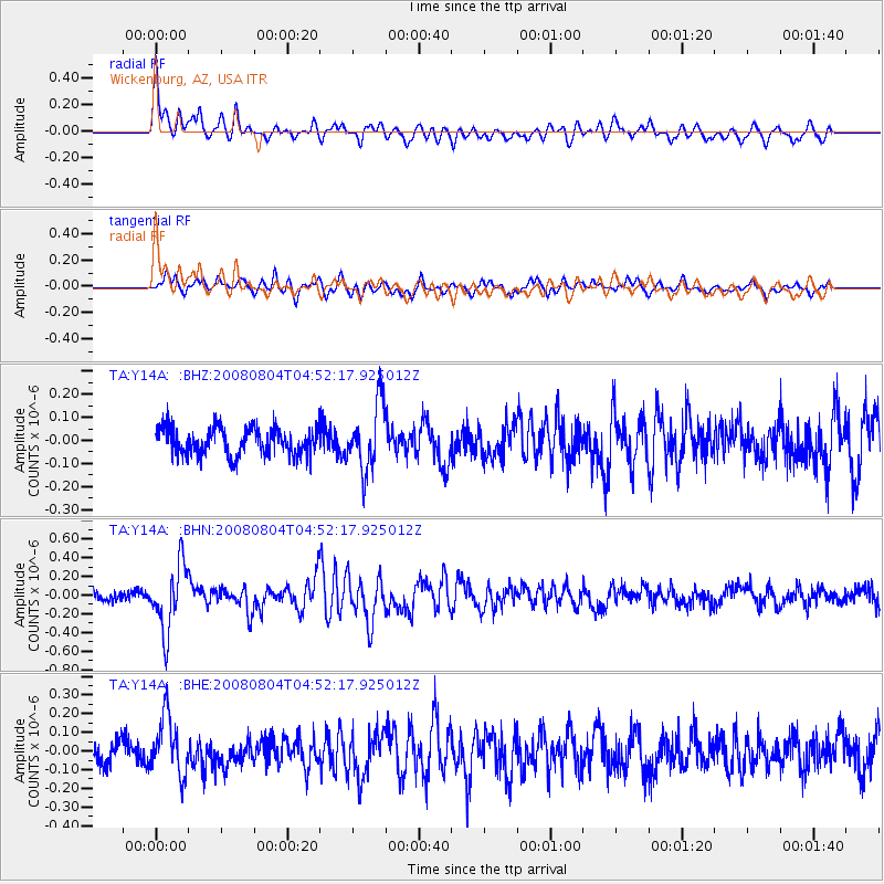
Y14A Wickenburg, AZ, USA - Earthquake Result Viewer
*The percent match for this event was below the threshold and hence no stack was calculated.
| Earthquake location: |
Kuril Islands |
| Earthquake latitude/longitude: |
49.9/156.4 |
| Earthquake time(UTC): |
2008/08/04 (217) 04:42:14 GMT |
| Earthquake Depth: |
77 km |
| Earthquake Magnitude: |
5.6 MB, 5.8 MW, 5.7 MW |
| Earthquake Catalog/Contributor: |
WHDF/NEIC |
|
| Network: |
TA USArray Transportable Network (new EarthScope stations) |
| Station: |
Y14A Wickenburg, AZ, USA |
| Lat/Lon: |
33.94 N/113.00 W |
| Elevation: |
731 m |
|
| Distance: |
65.3 deg |
| Az: |
66.208 deg |
| Baz: |
314.568 deg |
| Ray Param: |
$rayparam |
*The percent match for this event was below the threshold and hence was not used in the summary stack. |
|
| Radial Match: |
74.80262 % |
| Radial Bump: |
400 |
| Transverse Match: |
70.15863 % |
| Transverse Bump: |
400 |
| SOD ConfigId: |
2504 |
| Insert Time: |
2010-03-07 05:17:55.271 +0000 |
| GWidth: |
2.5 |
| Max Bumps: |
400 |
| Tol: |
0.001 |
|
Signal To Noise
| Channel | StoN | STA | LTA |
| TA:Y14A: :BHN:20080804T04:52:17.925012Z | 4.3693895 | 3.5339292E-7 | 8.0879246E-8 |
| TA:Y14A: :BHE:20080804T04:52:17.925012Z | 2.8683963 | 1.5661325E-7 | 5.459959E-8 |
| TA:Y14A: :BHZ:20080804T04:52:17.925012Z | 2.4146228 | 1.4239203E-7 | 5.897071E-8 |
| Arrivals |
| Ps | |
| PpPs | |
| PsPs/PpSs | |


