You are here: Home > Network List > US - United States National Seismic Network Stations List
> Station MNTX Cornudas Mountains, Texas, USA > Earthquake Result Viewer
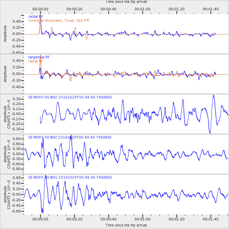
MNTX Cornudas Mountains, Texas, USA - Earthquake Result Viewer
*The percent match for this event was below the threshold and hence no stack was calculated.
| Earthquake location: |
Fox Islands, Aleutian Islands |
| Earthquake latitude/longitude: |
52.3/-170.2 |
| Earthquake time(UTC): |
2019/10/26 (299) 00:41:25 GMT |
| Earthquake Depth: |
35 km |
| Earthquake Magnitude: |
5.8 mww |
| Earthquake Catalog/Contributor: |
NEIC PDE/us |
|
| Network: |
US United States National Seismic Network |
| Station: |
MNTX Cornudas Mountains, Texas, USA |
| Lat/Lon: |
31.70 N/105.38 W |
| Elevation: |
404 m |
|
| Distance: |
50.5 deg |
| Az: |
87.452 deg |
| Baz: |
314.024 deg |
| Ray Param: |
$rayparam |
*The percent match for this event was below the threshold and hence was not used in the summary stack. |
|
| Radial Match: |
69.36394 % |
| Radial Bump: |
363 |
| Transverse Match: |
76.33454 % |
| Transverse Bump: |
400 |
| SOD ConfigId: |
19951751 |
| Insert Time: |
2019-11-09 00:56:21.966 +0000 |
| GWidth: |
2.5 |
| Max Bumps: |
400 |
| Tol: |
0.001 |
|
Signal To Noise
| Channel | StoN | STA | LTA |
| US:MNTX:00:BHZ:20191026T00:49:49.749989Z | 2.2806113 | 4.5752617E-7 | 2.006156E-7 |
| US:MNTX:00:BH1:20191026T00:49:49.749989Z | 3.0517967 | 4.162084E-7 | 1.3638143E-7 |
| US:MNTX:00:BH2:20191026T00:49:49.749989Z | 1.002881 | 9.171644E-8 | 9.1452954E-8 |
| Arrivals |
| Ps | |
| PpPs | |
| PsPs/PpSs | |


