You are here: Home > Network List > TA - USArray Transportable Network (new EarthScope stations) Stations List
> Station Y14A Wickenburg, AZ, USA > Earthquake Result Viewer
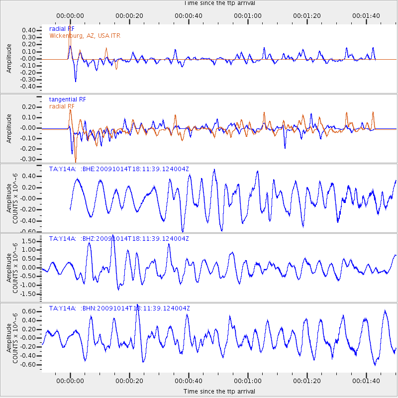
Y14A Wickenburg, AZ, USA - Earthquake Result Viewer
*The percent match for this event was below the threshold and hence no stack was calculated.
| Earthquake location: |
Samoa Islands Region |
| Earthquake latitude/longitude: |
-14.9/-174.8 |
| Earthquake time(UTC): |
2009/10/14 (287) 18:00:21 GMT |
| Earthquake Depth: |
10 km |
| Earthquake Magnitude: |
5.7 MB, 6.0 MS, 6.3 MW, 6.2 MW |
| Earthquake Catalog/Contributor: |
WHDF/NEIC |
|
| Network: |
TA USArray Transportable Network (new EarthScope stations) |
| Station: |
Y14A Wickenburg, AZ, USA |
| Lat/Lon: |
33.94 N/113.00 W |
| Elevation: |
731 m |
|
| Distance: |
76.3 deg |
| Az: |
48.973 deg |
| Baz: |
241.312 deg |
| Ray Param: |
$rayparam |
*The percent match for this event was below the threshold and hence was not used in the summary stack. |
|
| Radial Match: |
67.40003 % |
| Radial Bump: |
400 |
| Transverse Match: |
57.88228 % |
| Transverse Bump: |
400 |
| SOD ConfigId: |
2622 |
| Insert Time: |
2010-03-07 05:18:22.511 +0000 |
| GWidth: |
2.5 |
| Max Bumps: |
400 |
| Tol: |
0.001 |
|
Signal To Noise
| Channel | StoN | STA | LTA |
| TA:Y14A: :BHZ:20091014T18:11:39.124004Z | 1.9915166 | 4.44342E-7 | 2.2311738E-7 |
| TA:Y14A: :BHN:20091014T18:11:39.124004Z | 0.96972907 | 1.7518505E-7 | 1.8065361E-7 |
| TA:Y14A: :BHE:20091014T18:11:39.124004Z | 1.3352922 | 2.5626605E-7 | 1.9191758E-7 |
| Arrivals |
| Ps | |
| PpPs | |
| PsPs/PpSs | |


