You are here: Home > Network List > TA - USArray Transportable Network (new EarthScope stations) Stations List
> Station E20K Nigu River, AK, USA > Earthquake Result Viewer
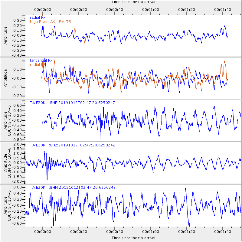
E20K Nigu River, AK, USA - Earthquake Result Viewer
*The percent match for this event was below the threshold and hence no stack was calculated.
| Earthquake location: |
New Britain Region, P.N.G. |
| Earthquake latitude/longitude: |
-5.1/152.6 |
| Earthquake time(UTC): |
2019/10/12 (285) 02:35:39 GMT |
| Earthquake Depth: |
44 km |
| Earthquake Magnitude: |
5.6 mb |
| Earthquake Catalog/Contributor: |
NEIC PDE/us |
|
| Network: |
TA USArray Transportable Network (new EarthScope stations) |
| Station: |
E20K Nigu River, AK, USA |
| Lat/Lon: |
68.26 N/156.19 W |
| Elevation: |
866 m |
|
| Distance: |
81.3 deg |
| Az: |
17.078 deg |
| Baz: |
231.732 deg |
| Ray Param: |
$rayparam |
*The percent match for this event was below the threshold and hence was not used in the summary stack. |
|
| Radial Match: |
39.352528 % |
| Radial Bump: |
400 |
| Transverse Match: |
69.05028 % |
| Transverse Bump: |
400 |
| SOD ConfigId: |
19951751 |
| Insert Time: |
2019-11-10 01:21:37.856 +0000 |
| GWidth: |
2.5 |
| Max Bumps: |
400 |
| Tol: |
0.001 |
|
Signal To Noise
| Channel | StoN | STA | LTA |
| TA:E20K: :BHZ:20191012T02:47:20.625024Z | 2.4350045 | 6.4496345E-7 | 2.6487157E-7 |
| TA:E20K: :BHN:20191012T02:47:20.625024Z | 1.1731063 | 2.2909657E-7 | 1.9529055E-7 |
| TA:E20K: :BHE:20191012T02:47:20.625024Z | 1.3784683 | 2.5308552E-7 | 1.8359908E-7 |
| Arrivals |
| Ps | |
| PpPs | |
| PsPs/PpSs | |


