You are here: Home > Network List > TA - USArray Transportable Network (new EarthScope stations) Stations List
> Station B18K Kokolik River, AK, USA > Earthquake Result Viewer
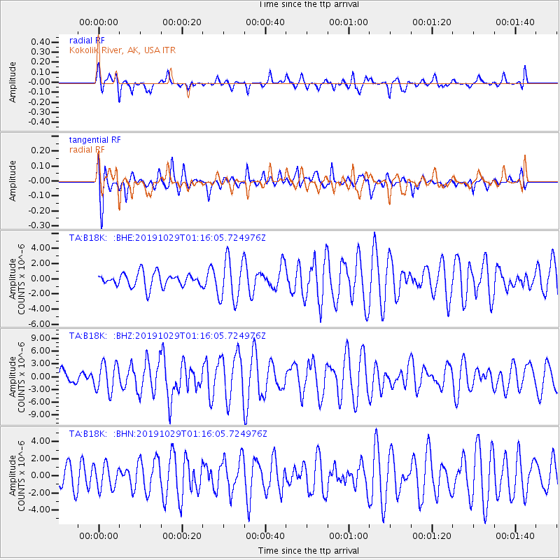
B18K Kokolik River, AK, USA - Earthquake Result Viewer
*The percent match for this event was below the threshold and hence no stack was calculated.
| Earthquake location: |
Mindanao, Philippines |
| Earthquake latitude/longitude: |
6.9/125.2 |
| Earthquake time(UTC): |
2019/10/29 (302) 01:04:46 GMT |
| Earthquake Depth: |
50 km |
| Earthquake Magnitude: |
6.8 Mi |
| Earthquake Catalog/Contributor: |
NEIC PDE/pt |
|
| Network: |
TA USArray Transportable Network (new EarthScope stations) |
| Station: |
B18K Kokolik River, AK, USA |
| Lat/Lon: |
69.36 N/161.80 W |
| Elevation: |
222 m |
|
| Distance: |
77.6 deg |
| Az: |
20.307 deg |
| Baz: |
256.394 deg |
| Ray Param: |
$rayparam |
*The percent match for this event was below the threshold and hence was not used in the summary stack. |
|
| Radial Match: |
57.225292 % |
| Radial Bump: |
400 |
| Transverse Match: |
68.5895 % |
| Transverse Bump: |
400 |
| SOD ConfigId: |
19951751 |
| Insert Time: |
2019-11-12 01:11:09.671 +0000 |
| GWidth: |
2.5 |
| Max Bumps: |
400 |
| Tol: |
0.001 |
|
Signal To Noise
| Channel | StoN | STA | LTA |
| TA:B18K: :BHZ:20191029T01:16:05.724976Z | 1.1348398 | 3.3544106E-6 | 2.955845E-6 |
| TA:B18K: :BHN:20191029T01:16:05.724976Z | 0.8424174 | 1.3786291E-6 | 1.6365154E-6 |
| TA:B18K: :BHE:20191029T01:16:05.724976Z | 3.114318 | 2.8039553E-6 | 9.0034337E-7 |
| Arrivals |
| Ps | |
| PpPs | |
| PsPs/PpSs | |


