You are here: Home > Network List > IU - Global Seismograph Network (GSN - IRIS/USGS) Stations List
> Station PMG Port Moresby, New Guinea > Earthquake Result Viewer
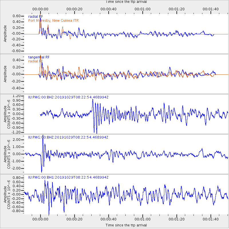
PMG Port Moresby, New Guinea - Earthquake Result Viewer
*The percent match for this event was below the threshold and hence no stack was calculated.
| Earthquake location: |
South Of Fiji Islands |
| Earthquake latitude/longitude: |
-23.4/-177.1 |
| Earthquake time(UTC): |
2019/10/29 (302) 08:16:32 GMT |
| Earthquake Depth: |
162 km |
| Earthquake Magnitude: |
5.5 Mww |
| Earthquake Catalog/Contributor: |
NEIC PDE/us |
|
| Network: |
IU Global Seismograph Network (GSN - IRIS/USGS) |
| Station: |
PMG Port Moresby, New Guinea |
| Lat/Lon: |
9.40 S/147.16 E |
| Elevation: |
90 m |
|
| Distance: |
36.9 deg |
| Az: |
286.163 deg |
| Baz: |
116.58 deg |
| Ray Param: |
$rayparam |
*The percent match for this event was below the threshold and hence was not used in the summary stack. |
|
| Radial Match: |
75.45633 % |
| Radial Bump: |
400 |
| Transverse Match: |
60.59162 % |
| Transverse Bump: |
400 |
| SOD ConfigId: |
19951751 |
| Insert Time: |
2019-11-12 08:25:37.882 +0000 |
| GWidth: |
2.5 |
| Max Bumps: |
400 |
| Tol: |
0.001 |
|
Signal To Noise
| Channel | StoN | STA | LTA |
| IU:PMG:00:BHZ:20191029T08:22:54.468994Z | 9.648454 | 1.0708501E-6 | 1.10986704E-7 |
| IU:PMG:00:BH1:20191029T08:22:54.468994Z | 2.1333556 | 3.243761E-7 | 1.5204971E-7 |
| IU:PMG:00:BH2:20191029T08:22:54.468994Z | 4.576791 | 5.9574194E-7 | 1.3016586E-7 |
| Arrivals |
| Ps | |
| PpPs | |
| PsPs/PpSs | |


