You are here: Home > Network List > TA - USArray Transportable Network (new EarthScope stations) Stations List
> Station I17K Unalakleet, AK, USA > Earthquake Result Viewer
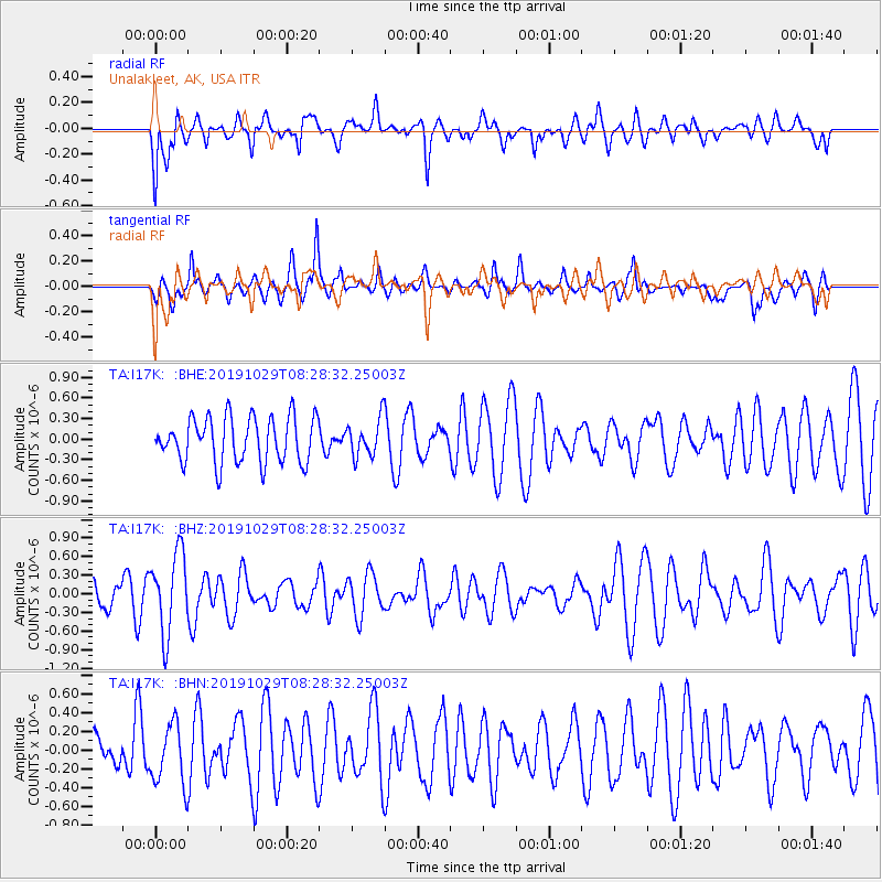
I17K Unalakleet, AK, USA - Earthquake Result Viewer
*The percent match for this event was below the threshold and hence no stack was calculated.
| Earthquake location: |
South Of Fiji Islands |
| Earthquake latitude/longitude: |
-23.4/-177.1 |
| Earthquake time(UTC): |
2019/10/29 (302) 08:16:32 GMT |
| Earthquake Depth: |
162 km |
| Earthquake Magnitude: |
5.5 Mww |
| Earthquake Catalog/Contributor: |
NEIC PDE/us |
|
| Network: |
TA USArray Transportable Network (new EarthScope stations) |
| Station: |
I17K Unalakleet, AK, USA |
| Lat/Lon: |
63.89 N/160.70 W |
| Elevation: |
105 m |
|
| Distance: |
87.9 deg |
| Az: |
7.185 deg |
| Baz: |
195.05 deg |
| Ray Param: |
$rayparam |
*The percent match for this event was below the threshold and hence was not used in the summary stack. |
|
| Radial Match: |
57.01207 % |
| Radial Bump: |
400 |
| Transverse Match: |
54.973175 % |
| Transverse Bump: |
347 |
| SOD ConfigId: |
19951751 |
| Insert Time: |
2019-11-12 08:27:33.846 +0000 |
| GWidth: |
2.5 |
| Max Bumps: |
400 |
| Tol: |
0.001 |
|
Signal To Noise
| Channel | StoN | STA | LTA |
| TA:I17K: :BHZ:20191029T08:28:32.25003Z | 3.9766216 | 6.440291E-7 | 1.6195382E-7 |
| TA:I17K: :BHN:20191029T08:28:32.25003Z | 1.0835274 | 3.2408917E-7 | 2.9910566E-7 |
| TA:I17K: :BHE:20191029T08:28:32.25003Z | 0.8231087 | 2.7022048E-7 | 3.282926E-7 |
| Arrivals |
| Ps | |
| PpPs | |
| PsPs/PpSs | |


