You are here: Home > Network List > TA - USArray Transportable Network (new EarthScope stations) Stations List
> Station P17K Kvichak River, AK, USA > Earthquake Result Viewer
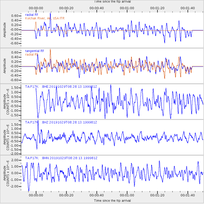
P17K Kvichak River, AK, USA - Earthquake Result Viewer
*The percent match for this event was below the threshold and hence no stack was calculated.
| Earthquake location: |
South Of Fiji Islands |
| Earthquake latitude/longitude: |
-23.4/-177.1 |
| Earthquake time(UTC): |
2019/10/29 (302) 08:16:32 GMT |
| Earthquake Depth: |
162 km |
| Earthquake Magnitude: |
5.5 Mww |
| Earthquake Catalog/Contributor: |
NEIC PDE/us |
|
| Network: |
TA USArray Transportable Network (new EarthScope stations) |
| Station: |
P17K Kvichak River, AK, USA |
| Lat/Lon: |
59.20 N/156.44 W |
| Elevation: |
91 m |
|
| Distance: |
84.0 deg |
| Az: |
10.52 deg |
| Baz: |
199.023 deg |
| Ray Param: |
$rayparam |
*The percent match for this event was below the threshold and hence was not used in the summary stack. |
|
| Radial Match: |
57.68129 % |
| Radial Bump: |
400 |
| Transverse Match: |
52.91973 % |
| Transverse Bump: |
400 |
| SOD ConfigId: |
19951751 |
| Insert Time: |
2019-11-12 08:27:44.361 +0000 |
| GWidth: |
2.5 |
| Max Bumps: |
400 |
| Tol: |
0.001 |
|
Signal To Noise
| Channel | StoN | STA | LTA |
| TA:P17K: :BHZ:20191029T08:28:13.199981Z | 2.1402636 | 7.825883E-7 | 3.656504E-7 |
| TA:P17K: :BHN:20191029T08:28:13.199981Z | 1.0612326 | 8.009476E-7 | 7.547334E-7 |
| TA:P17K: :BHE:20191029T08:28:13.199981Z | 0.73475605 | 5.262357E-7 | 7.162046E-7 |
| Arrivals |
| Ps | |
| PpPs | |
| PsPs/PpSs | |


