You are here: Home > Network List > US - United States National Seismic Network Stations List
> Station DGMT Dagmar, Montana, USA > Earthquake Result Viewer
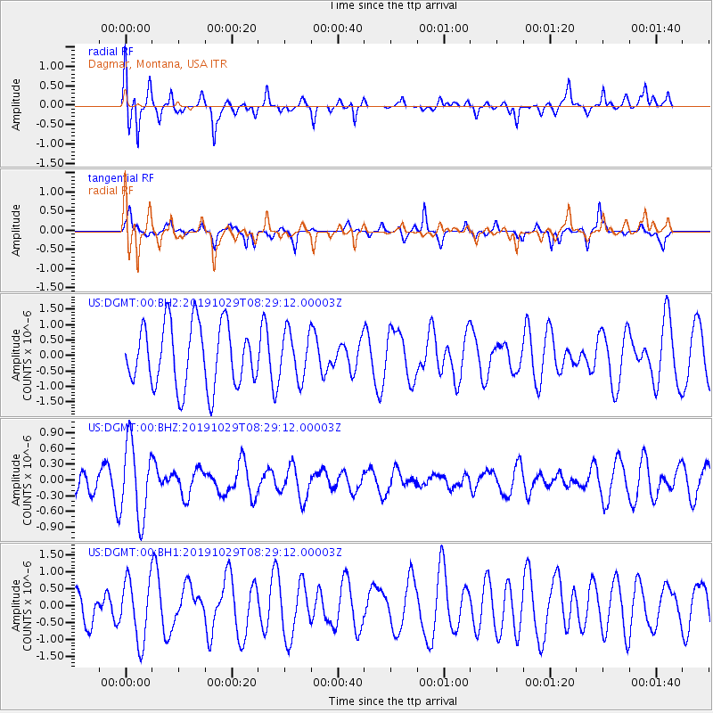
DGMT Dagmar, Montana, USA - Earthquake Result Viewer
*The percent match for this event was below the threshold and hence no stack was calculated.
| Earthquake location: |
South Of Fiji Islands |
| Earthquake latitude/longitude: |
-23.4/-177.1 |
| Earthquake time(UTC): |
2019/10/29 (302) 08:16:32 GMT |
| Earthquake Depth: |
162 km |
| Earthquake Magnitude: |
5.5 Mww |
| Earthquake Catalog/Contributor: |
NEIC PDE/us |
|
| Network: |
US United States National Seismic Network |
| Station: |
DGMT Dagmar, Montana, USA |
| Lat/Lon: |
48.47 N/104.20 W |
| Elevation: |
0.0 m |
|
| Distance: |
96.6 deg |
| Az: |
39.818 deg |
| Baz: |
242.133 deg |
| Ray Param: |
$rayparam |
*The percent match for this event was below the threshold and hence was not used in the summary stack. |
|
| Radial Match: |
58.921543 % |
| Radial Bump: |
334 |
| Transverse Match: |
45.168648 % |
| Transverse Bump: |
226 |
| SOD ConfigId: |
19951751 |
| Insert Time: |
2019-11-12 08:28:29.050 +0000 |
| GWidth: |
2.5 |
| Max Bumps: |
400 |
| Tol: |
0.001 |
|
Signal To Noise
| Channel | StoN | STA | LTA |
| US:DGMT:00:BHZ:20191029T08:29:12.00003Z | 2.7465727 | 7.1784643E-7 | 2.6136078E-7 |
| US:DGMT:00:BH1:20191029T08:29:12.00003Z | 1.5494177 | 9.201099E-7 | 5.9384234E-7 |
| US:DGMT:00:BH2:20191029T08:29:12.00003Z | 0.74992037 | 7.593555E-7 | 1.0125815E-6 |
| Arrivals |
| Ps | |
| PpPs | |
| PsPs/PpSs | |


