You are here: Home > Network List > G - GEOSCOPE Stations List
> Station MPG Montagne des Peres, French Guyana > Earthquake Result Viewer
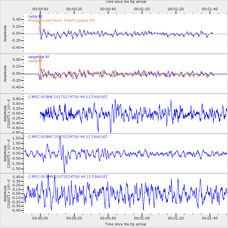
MPG Montagne des Peres, French Guyana - Earthquake Result Viewer
*The percent match for this event was below the threshold and hence no stack was calculated.
| Earthquake location: |
Lake Tanganyika Region |
| Earthquake latitude/longitude: |
-8.5/30.1 |
| Earthquake time(UTC): |
2017/02/24 (055) 00:32:17 GMT |
| Earthquake Depth: |
27 km |
| Earthquake Magnitude: |
5.9 Mww |
| Earthquake Catalog/Contributor: |
NEIC PDE/us |
|
| Network: |
G GEOSCOPE |
| Station: |
MPG Montagne des Peres, French Guyana |
| Lat/Lon: |
5.11 N/52.64 W |
| Elevation: |
147 m |
|
| Distance: |
83.6 deg |
| Az: |
276.122 deg |
| Baz: |
99.08 deg |
| Ray Param: |
$rayparam |
*The percent match for this event was below the threshold and hence was not used in the summary stack. |
|
| Radial Match: |
72.00667 % |
| Radial Bump: |
400 |
| Transverse Match: |
56.301144 % |
| Transverse Bump: |
400 |
| SOD ConfigId: |
1992691 |
| Insert Time: |
2017-03-10 00:33:04.937 +0000 |
| GWidth: |
2.5 |
| Max Bumps: |
400 |
| Tol: |
0.001 |
|
Signal To Noise
| Channel | StoN | STA | LTA |
| G:MPG:00:BHZ:20170224T00:44:11.599016Z | 2.4727836 | 4.2130546E-7 | 1.7037699E-7 |
| G:MPG:00:BHN:20170224T00:44:11.599016Z | 1.5713607 | 1.8873075E-7 | 1.2010658E-7 |
| G:MPG:00:BHE:20170224T00:44:11.599016Z | 1.768593 | 2.6342875E-7 | 1.489482E-7 |
| Arrivals |
| Ps | |
| PpPs | |
| PsPs/PpSs | |


