U14A Mt Trumbull, AZ, USA - Earthquake Result Viewer
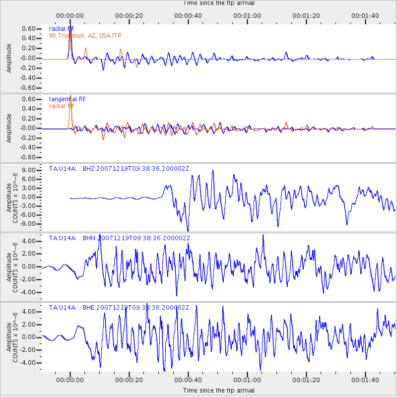
Earthquake location: Andreanof Islands, Aleutian Is.
Earthquake latitude/longitude: 51.4/-179.5
Earthquake time(UTC): 2007/12/19 (353) 09:30:27 GMT
Earthquake Depth: 29 km
Earthquake Magnitude: 6.4 MB, 7.1 MS, 7.1 MW, 7.0 MW
Earthquake Catalog/Contributor: WHDF/NEIC
Network: TA USArray Transportable Network (new EarthScope stations)
Station: U14A Mt Trumbull, AZ, USA
Lat/Lon: 36.42 N/113.18 W
Elevation: 1916 m
Distance: 48.4 deg
Az: 80.894 deg
Baz: 309.873 deg
Ray Param: 0.069306806
Estimated Moho Depth: 19.25 km
Estimated Crust Vp/Vs: 1.89
Assumed Crust Vp: 6.194 km/s
Estimated Crust Vs: 3.282 km/s
Estimated Crust Poisson's Ratio: 0.30
Radial Match: 95.40298 %
Radial Bump: 400
Transverse Match: 81.22611 %
Transverse Bump: 400
SOD ConfigId: 2564
Insert Time: 2010-03-07 05:22:28.199 +0000
GWidth: 2.5
Max Bumps: 400
Tol: 0.001

Signal To Noise

ChannelStoNSTALTA
TA:U14A: :BHN:20071219T09:38:36.200002Z4.29720541.0585777E-62.4634096E-7
TA:U14A: :BHE:20071219T09:38:36.200002Z5.7292621.178721E-62.0573698E-7
TA:U14A: :BHZ:20071219T09:38:36.200002Z16.33112.5850545E-61.5829028E-7
Arrivals
Ps2.9 SECOND
PpPs8.5 SECOND
PsPs/PpSs11 SECOND