U14A Mt Trumbull, AZ, USA - Earthquake Result Viewer
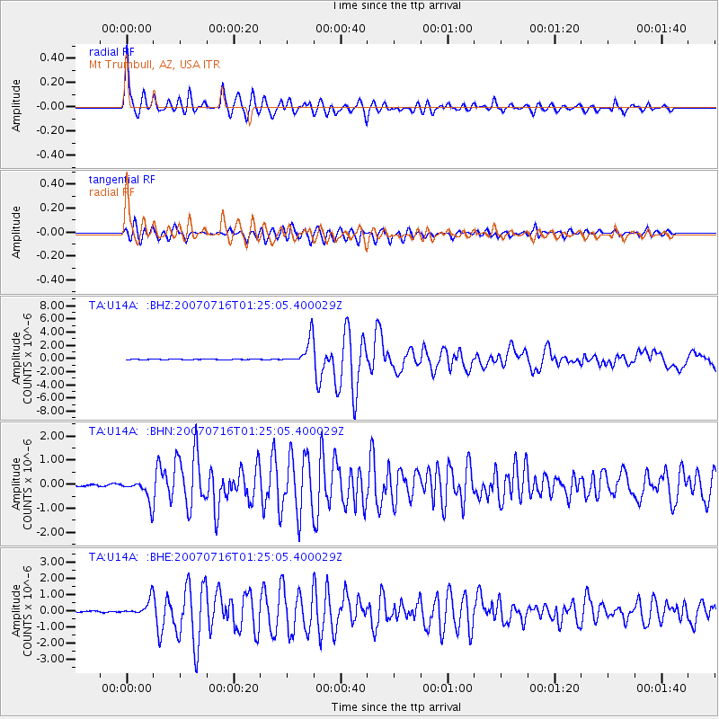
Earthquake location: Near West Coast Of Honshu, Japan
Earthquake latitude/longitude: 37.5/138.4
Earthquake time(UTC): 2007/07/16 (197) 01:13:22 GMT
Earthquake Depth: 12 km
Earthquake Magnitude: 6.5 MB, 6.4 MS, 6.6 MW, 6.5 MW
Earthquake Catalog/Contributor: WHDF/NEIC
Network: TA USArray Transportable Network (new EarthScope stations)
Station: U14A Mt Trumbull, AZ, USA
Lat/Lon: 36.42 N/113.18 W
Elevation: 1916 m
Distance: 81.0 deg
Az: 50.808 deg
Baz: 310.196 deg
Ray Param: 0.047892705
Estimated Moho Depth: 69.25 km
Estimated Crust Vp/Vs: 2.03
Assumed Crust Vp: 6.194 km/s
Estimated Crust Vs: 3.048 km/s
Estimated Crust Poisson's Ratio: 0.34
Radial Match: 95.10136 %
Radial Bump: 400
Transverse Match: 87.765656 %
Transverse Bump: 400
SOD ConfigId: 2564
Insert Time: 2010-03-07 05:22:59.862 +0000
GWidth: 2.5
Max Bumps: 400
Tol: 0.001

Signal To Noise

ChannelStoNSTALTA
TA:U14A: :BHN:20070716T01:25:05.400029Z10.3618224.664891E-74.5019988E-8
TA:U14A: :BHE:20070716T01:25:05.400029Z11.6233965.0663834E-74.3587807E-8
TA:U14A: :BHZ:20070716T01:25:05.400029Z43.713912.0210994E-64.62347E-8
Arrivals
Ps12 SECOND
PpPs33 SECOND
PsPs/PpSs45 SECOND