
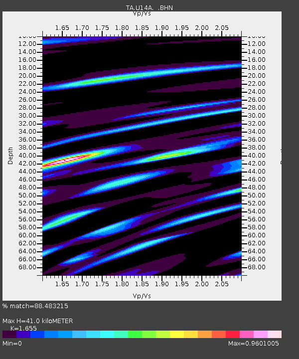
U14A Mt Trumbull, AZ, USA - Earthquake Result Viewer
| ||||||||||||||||||
| ||||||||||||||||||
| ||||||||||||||||||
|
Signal To Noise
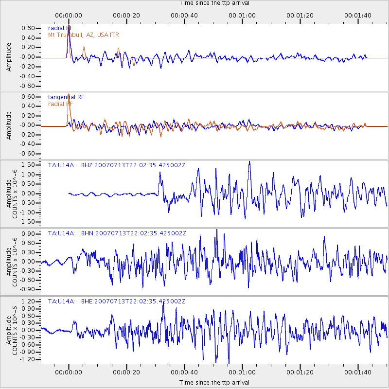
| Channel | StoN | STA | LTA |
| TA:U14A: :BHN:20070713T22:02:35.425002Z | 5.087293 | 2.1946343E-7 | 4.3139533E-8 |
| TA:U14A: :BHE:20070713T22:02:35.425002Z | 2.1637962 | 1.9780431E-7 | 9.141541E-8 |
| TA:U14A: :BHZ:20070713T22:02:35.425002Z | 9.68764 | 4.9555587E-7 | 5.1153418E-8 |
| Arrivals | |
| Ps | 4.6 SECOND |
| PpPs | 17 SECOND |
| PsPs/PpSs | 21 SECOND |

