U14A Mt Trumbull, AZ, USA - Earthquake Result Viewer
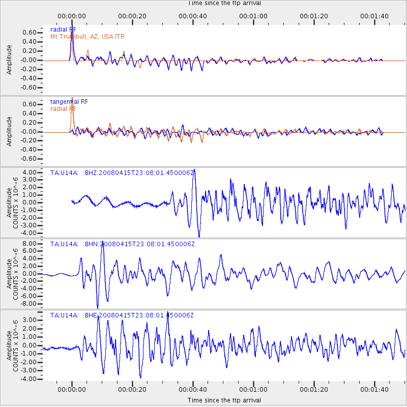
Earthquake location: Andreanof Islands, Aleutian Is.
Earthquake latitude/longitude: 51.9/-179.4
Earthquake time(UTC): 2008/04/15 (106) 22:59:51 GMT
Earthquake Depth: 10 km
Earthquake Magnitude: 6.1 MB, 6.4 MS, 6.4 MW, 6.4 MW
Earthquake Catalog/Contributor: WHDF/NEIC
Network: TA USArray Transportable Network (new EarthScope stations)
Station: U14A Mt Trumbull, AZ, USA
Lat/Lon: 36.42 N/113.18 W
Elevation: 1916 m
Distance: 48.3 deg
Az: 81.441 deg
Baz: 310.502 deg
Ray Param: 0.06947333
Estimated Moho Depth: 61.5 km
Estimated Crust Vp/Vs: 1.88
Assumed Crust Vp: 6.194 km/s
Estimated Crust Vs: 3.286 km/s
Estimated Crust Poisson's Ratio: 0.30
Radial Match: 93.54945 %
Radial Bump: 400
Transverse Match: 71.89775 %
Transverse Bump: 400
SOD ConfigId: 2504
Insert Time: 2010-03-07 05:23:14.903 +0000
GWidth: 2.5
Max Bumps: 400
Tol: 0.001

Signal To Noise

ChannelStoNSTALTA
TA:U14A: :BHN:20080415T23:08:01.450006Z8.4887811.7915681E-62.1105129E-7
TA:U14A: :BHE:20080415T23:08:01.450006Z1.88493457.9130774E-74.1980647E-7
TA:U14A: :BHZ:20080415T23:08:01.450006Z1.7512347.047444E-74.0242733E-7
Arrivals
Ps9.3 SECOND
PpPs27 SECOND
PsPs/PpSs36 SECOND