You are here: Home > Network List > TA - USArray Transportable Network (new EarthScope stations) Stations List
> Station U14A Mt Trumbull, AZ, USA > Earthquake Result Viewer
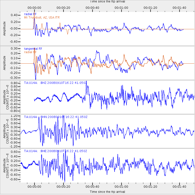
U14A Mt Trumbull, AZ, USA - Earthquake Result Viewer
*The percent match for this event was below the threshold and hence no stack was calculated.
| Earthquake location: |
Northern Chile |
| Earthquake latitude/longitude: |
-20.3/-69.2 |
| Earthquake time(UTC): |
2008/09/10 (254) 16:12:04 GMT |
| Earthquake Depth: |
38 km |
| Earthquake Magnitude: |
5.6 MB, 5.3 MS |
| Earthquake Catalog/Contributor: |
WHDF/NEIC |
|
| Network: |
TA USArray Transportable Network (new EarthScope stations) |
| Station: |
U14A Mt Trumbull, AZ, USA |
| Lat/Lon: |
36.42 N/113.18 W |
| Elevation: |
1916 m |
|
| Distance: |
70.0 deg |
| Az: |
323.436 deg |
| Baz: |
136.1 deg |
| Ray Param: |
$rayparam |
*The percent match for this event was below the threshold and hence was not used in the summary stack. |
|
| Radial Match: |
72.13323 % |
| Radial Bump: |
400 |
| Transverse Match: |
64.90167 % |
| Transverse Bump: |
400 |
| SOD ConfigId: |
2504 |
| Insert Time: |
2010-03-07 05:23:52.178 +0000 |
| GWidth: |
2.5 |
| Max Bumps: |
400 |
| Tol: |
0.001 |
|
Signal To Noise
| Channel | StoN | STA | LTA |
| TA:U14A: :BHN:20080910T16:22:41.050Z | 3.3309162 | 4.3118825E-7 | 1.2945034E-7 |
| TA:U14A: :BHE:20080910T16:22:41.050Z | 1.8669511 | 1.8807069E-7 | 1.00736806E-7 |
| TA:U14A: :BHZ:20080910T16:22:41.050Z | 1.2658165 | 1.5993237E-7 | 1.263472E-7 |
| Arrivals |
| Ps | |
| PpPs | |
| PsPs/PpSs | |


