You are here: Home > Network List > TA - USArray Transportable Network (new EarthScope stations) Stations List
> Station U14A Mt Trumbull, AZ, USA > Earthquake Result Viewer
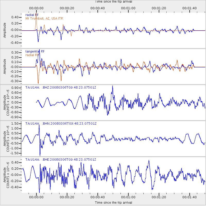
U14A Mt Trumbull, AZ, USA - Earthquake Result Viewer
*The percent match for this event was below the threshold and hence no stack was calculated.
| Earthquake location: |
Kamchatka Peninsula, Russia |
| Earthquake latitude/longitude: |
51.5/156.5 |
| Earthquake time(UTC): |
2008/03/06 (066) 09:38:43 GMT |
| Earthquake Depth: |
134 km |
| Earthquake Magnitude: |
5.6 MB, 5.5 MW, 5.5 MW |
| Earthquake Catalog/Contributor: |
WHDF/NEIC |
|
| Network: |
TA USArray Transportable Network (new EarthScope stations) |
| Station: |
U14A Mt Trumbull, AZ, USA |
| Lat/Lon: |
36.42 N/113.18 W |
| Elevation: |
1916 m |
|
| Distance: |
62.7 deg |
| Az: |
65.223 deg |
| Baz: |
315.31 deg |
| Ray Param: |
$rayparam |
*The percent match for this event was below the threshold and hence was not used in the summary stack. |
|
| Radial Match: |
46.799408 % |
| Radial Bump: |
400 |
| Transverse Match: |
70.8873 % |
| Transverse Bump: |
400 |
| SOD ConfigId: |
2504 |
| Insert Time: |
2010-03-07 05:23:59.724 +0000 |
| GWidth: |
2.5 |
| Max Bumps: |
400 |
| Tol: |
0.001 |
|
Signal To Noise
| Channel | StoN | STA | LTA |
| TA:U14A: :BHN:20080306T09:48:23.07501Z | 3.1243086 | 7.0556257E-7 | 2.2583E-7 |
| TA:U14A: :BHE:20080306T09:48:23.07501Z | 2.0041742 | 2.0242899E-7 | 1.01003685E-7 |
| TA:U14A: :BHZ:20080306T09:48:23.07501Z | 2.1415727 | 3.206534E-7 | 1.49728E-7 |
| Arrivals |
| Ps | |
| PpPs | |
| PsPs/PpSs | |


