You are here: Home > Network List > TA - USArray Transportable Network (new EarthScope stations) Stations List
> Station U14A Mt Trumbull, AZ, USA > Earthquake Result Viewer
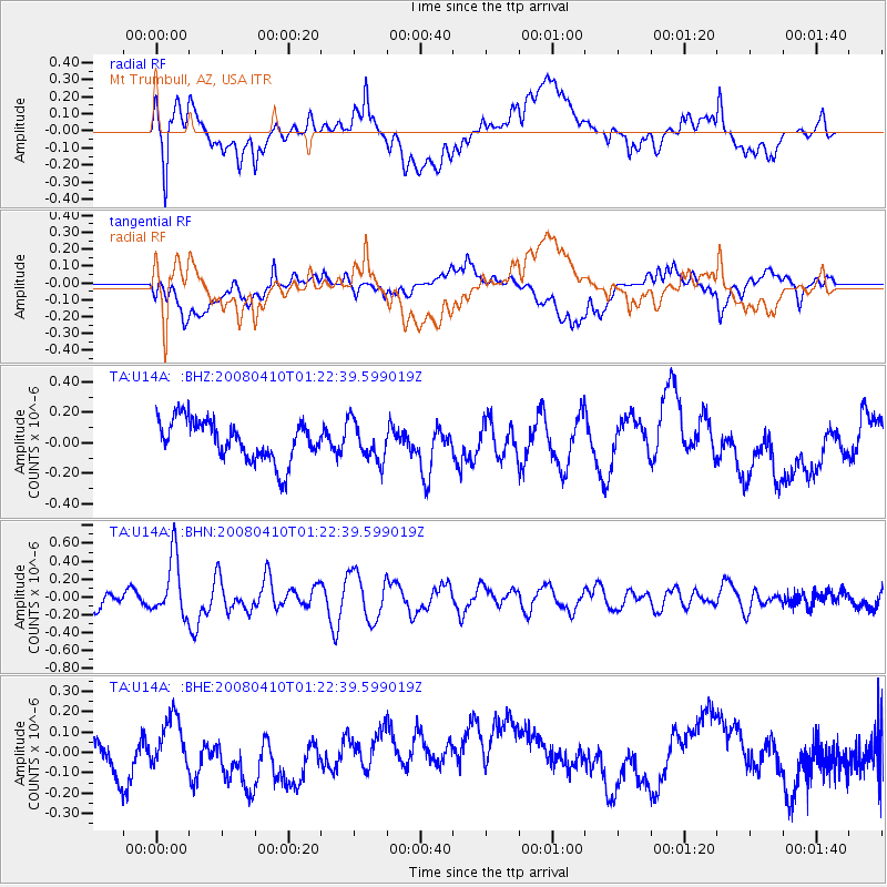
U14A Mt Trumbull, AZ, USA - Earthquake Result Viewer
*The percent match for this event was below the threshold and hence no stack was calculated.
| Earthquake location: |
Loyalty Islands |
| Earthquake latitude/longitude: |
-20.3/168.9 |
| Earthquake time(UTC): |
2008/04/10 (101) 01:10:02 GMT |
| Earthquake Depth: |
35 km |
| Earthquake Magnitude: |
5.5 MB, 5.5 MS, 5.8 MW |
| Earthquake Catalog/Contributor: |
WHDF/NEIC |
|
| Network: |
TA USArray Transportable Network (new EarthScope stations) |
| Station: |
U14A Mt Trumbull, AZ, USA |
| Lat/Lon: |
36.42 N/113.18 W |
| Elevation: |
1916 m |
|
| Distance: |
92.6 deg |
| Az: |
52.133 deg |
| Baz: |
246.704 deg |
| Ray Param: |
$rayparam |
*The percent match for this event was below the threshold and hence was not used in the summary stack. |
|
| Radial Match: |
63.560627 % |
| Radial Bump: |
400 |
| Transverse Match: |
60.148445 % |
| Transverse Bump: |
400 |
| SOD ConfigId: |
2504 |
| Insert Time: |
2010-03-07 05:24:04.554 +0000 |
| GWidth: |
2.5 |
| Max Bumps: |
400 |
| Tol: |
0.001 |
|
Signal To Noise
| Channel | StoN | STA | LTA |
| TA:U14A: :BHN:20080410T01:22:39.599019Z | 3.0667691 | 3.2763762E-7 | 1.0683478E-7 |
| TA:U14A: :BHE:20080410T01:22:39.599019Z | 0.70244235 | 1.0059947E-7 | 1.4321384E-7 |
| TA:U14A: :BHZ:20080410T01:22:39.599019Z | 0.9508658 | 1.2558229E-7 | 1.3207152E-7 |
| Arrivals |
| Ps | |
| PpPs | |
| PsPs/PpSs | |


