You are here: Home > Network List > IW - Intermountain West Stations List
> Station MOOW Moose Ponds, Wyoming, USA > Earthquake Result Viewer
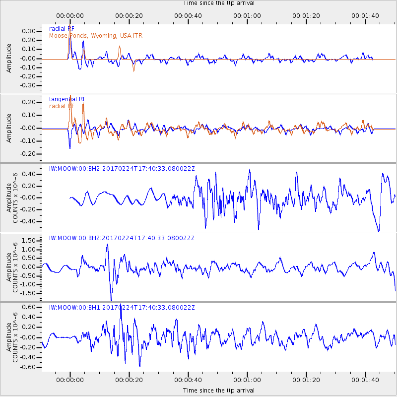
MOOW Moose Ponds, Wyoming, USA - Earthquake Result Viewer
*The percent match for this event was below the threshold and hence no stack was calculated.
| Earthquake location: |
South Of Fiji Islands |
| Earthquake latitude/longitude: |
-23.2/-178.8 |
| Earthquake time(UTC): |
2017/02/24 (055) 17:28:44 GMT |
| Earthquake Depth: |
415 km |
| Earthquake Magnitude: |
6.9 mww |
| Earthquake Catalog/Contributor: |
NEIC PDE/us |
|
| Network: |
IW Intermountain West |
| Station: |
MOOW Moose Ponds, Wyoming, USA |
| Lat/Lon: |
43.75 N/110.74 W |
| Elevation: |
2128 m |
|
| Distance: |
91.2 deg |
| Az: |
42.261 deg |
| Baz: |
238.6 deg |
| Ray Param: |
$rayparam |
*The percent match for this event was below the threshold and hence was not used in the summary stack. |
|
| Radial Match: |
67.25442 % |
| Radial Bump: |
329 |
| Transverse Match: |
52.32335 % |
| Transverse Bump: |
273 |
| SOD ConfigId: |
1992691 |
| Insert Time: |
2017-03-10 17:31:09.142 +0000 |
| GWidth: |
2.5 |
| Max Bumps: |
400 |
| Tol: |
0.001 |
|
Signal To Noise
| Channel | StoN | STA | LTA |
| IW:MOOW:00:BHZ:20170224T17:40:33.080022Z | 2.0556068 | 2.867135E-7 | 1.3947876E-7 |
| IW:MOOW:00:BH1:20170224T17:40:33.080022Z | 0.618432 | 4.8804065E-8 | 7.891582E-8 |
| IW:MOOW:00:BH2:20170224T17:40:33.080022Z | 0.9973219 | 7.077978E-8 | 7.096985E-8 |
| Arrivals |
| Ps | |
| PpPs | |
| PsPs/PpSs | |


