You are here: Home > Network List > IW - Intermountain West Stations List
> Station PLID Pearl Lake, Idaho, USA > Earthquake Result Viewer
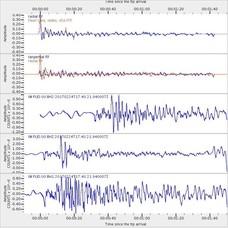
PLID Pearl Lake, Idaho, USA - Earthquake Result Viewer
*The percent match for this event was below the threshold and hence no stack was calculated.
| Earthquake location: |
South Of Fiji Islands |
| Earthquake latitude/longitude: |
-23.2/-178.8 |
| Earthquake time(UTC): |
2017/02/24 (055) 17:28:44 GMT |
| Earthquake Depth: |
415 km |
| Earthquake Magnitude: |
6.9 mww |
| Earthquake Catalog/Contributor: |
NEIC PDE/us |
|
| Network: |
IW Intermountain West |
| Station: |
PLID Pearl Lake, Idaho, USA |
| Lat/Lon: |
45.09 N/116.00 W |
| Elevation: |
2164 m |
|
| Distance: |
88.8 deg |
| Az: |
39.079 deg |
| Baz: |
234.934 deg |
| Ray Param: |
$rayparam |
*The percent match for this event was below the threshold and hence was not used in the summary stack. |
|
| Radial Match: |
77.88338 % |
| Radial Bump: |
400 |
| Transverse Match: |
57.53114 % |
| Transverse Bump: |
400 |
| SOD ConfigId: |
1992691 |
| Insert Time: |
2017-03-10 17:31:10.594 +0000 |
| GWidth: |
2.5 |
| Max Bumps: |
400 |
| Tol: |
0.001 |
|
Signal To Noise
| Channel | StoN | STA | LTA |
| IW:PLID:00:BHZ:20170224T17:40:21.940007Z | 2.763594 | 4.8557695E-7 | 1.7570488E-7 |
| IW:PLID:00:BH1:20170224T17:40:21.940007Z | 1.9564805 | 1.5936348E-7 | 8.145416E-8 |
| IW:PLID:00:BH2:20170224T17:40:21.940007Z | 1.4192007 | 1.7675984E-7 | 1.2454886E-7 |
| Arrivals |
| Ps | |
| PpPs | |
| PsPs/PpSs | |


