
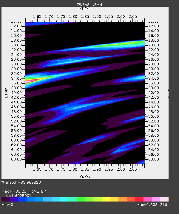
PAS Pasadena, California, USA - Earthquake Result Viewer
| ||||||||||||||||||
| ||||||||||||||||||
| ||||||||||||||||||
|
Signal To Noise
| Channel | StoN | STA | LTA |
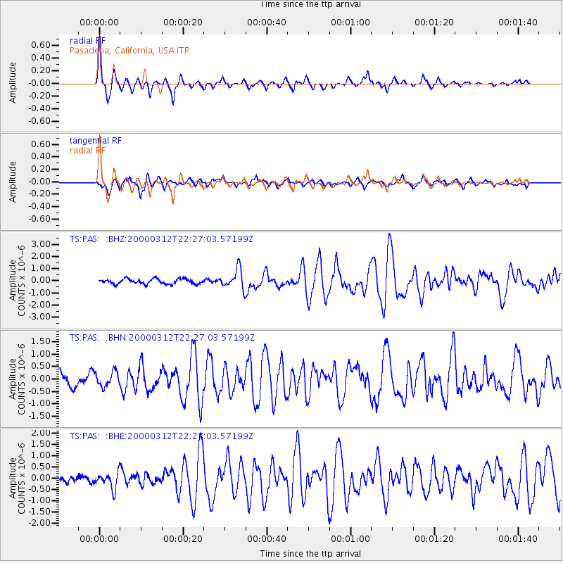
| TS:PAS: :BHN:20000312T22:27:03.57199Z | 0.6145833 | 3.0067278E-7 | 4.8923033E-7 |
| TS:PAS: :BHE:20000312T22:27:03.57199Z | 2.0150652 | 3.6455586E-7 | 1.8091515E-7 |
| TS:PAS: :BHZ:20000312T22:27:03.57199Z | 4.0909724 | 8.266287E-7 | 2.0206167E-7 |
| Arrivals | |
| Ps | 3.8 SECOND |
| PpPs | 14 SECOND |
| PsPs/PpSs | 18 SECOND |

