You are here: Home > Network List > US - United States National Seismic Network Stations List
> Station DUG Dugway, Tooele County, Utah, USA > Earthquake Result Viewer
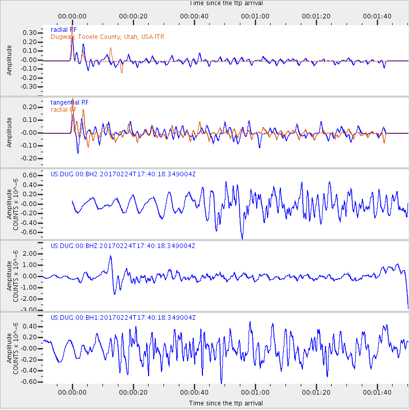
DUG Dugway, Tooele County, Utah, USA - Earthquake Result Viewer
*The percent match for this event was below the threshold and hence no stack was calculated.
| Earthquake location: |
South Of Fiji Islands |
| Earthquake latitude/longitude: |
-23.2/-178.8 |
| Earthquake time(UTC): |
2017/02/24 (055) 17:28:44 GMT |
| Earthquake Depth: |
415 km |
| Earthquake Magnitude: |
6.9 mww |
| Earthquake Catalog/Contributor: |
NEIC PDE/us |
|
| Network: |
US United States National Seismic Network |
| Station: |
DUG Dugway, Tooele County, Utah, USA |
| Lat/Lon: |
40.19 N/112.81 W |
| Elevation: |
1477 m |
|
| Distance: |
88.0 deg |
| Az: |
44.45 deg |
| Baz: |
237.234 deg |
| Ray Param: |
$rayparam |
*The percent match for this event was below the threshold and hence was not used in the summary stack. |
|
| Radial Match: |
68.48787 % |
| Radial Bump: |
389 |
| Transverse Match: |
66.95763 % |
| Transverse Bump: |
400 |
| SOD ConfigId: |
1992691 |
| Insert Time: |
2017-03-10 17:31:33.501 +0000 |
| GWidth: |
2.5 |
| Max Bumps: |
400 |
| Tol: |
0.001 |
|
Signal To Noise
| Channel | StoN | STA | LTA |
| US:DUG:00:BHZ:20170224T17:40:18.349004Z | 2.135953 | 2.7102016E-7 | 1.268849E-7 |
| US:DUG:00:BH1:20170224T17:40:18.349004Z | 0.801925 | 1.102027E-7 | 1.374227E-7 |
| US:DUG:00:BH2:20170224T17:40:18.349004Z | 1.8506689 | 1.8501431E-7 | 9.9971594E-8 |
| Arrivals |
| Ps | |
| PpPs | |
| PsPs/PpSs | |


