
PAS Pasadena, California, USA - Earthquake Result Viewer
| ||||||||||||||||||
| ||||||||||||||||||
| ||||||||||||||||||
|
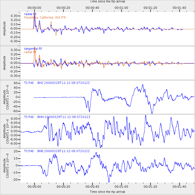
Signal To Noise
| Channel | StoN | STA | LTA |
| TS:PAS: :BHN:20000328T11:12:08.072012Z | 1.1445554 | 2.8618948E-7 | 2.5004422E-7 |
| TS:PAS: :BHE:20000328T11:12:08.072012Z | 2.371624 | 4.806809E-7 | 2.0268008E-7 |
| TS:PAS: :BHZ:20000328T11:12:08.072012Z | 4.014178 | 1.9527897E-6 | 4.8647314E-7 |
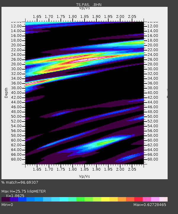
| Arrivals | |
| Ps | 3.7 SECOND |
| PpPs | 12 SECOND |
| PsPs/PpSs | 16 SECOND |

