PAS Pasadena, California, USA - Earthquake Result Viewer
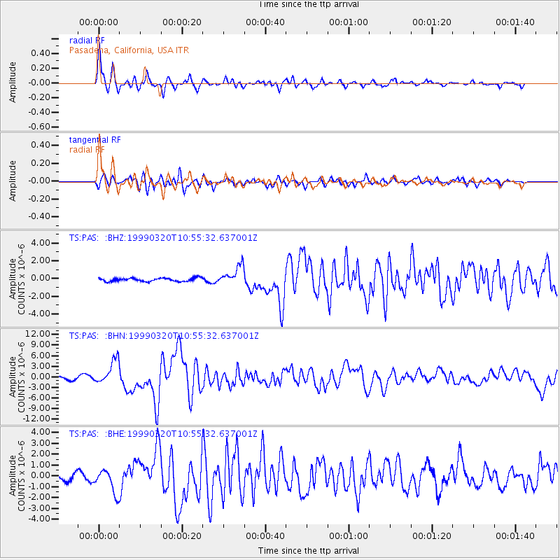
Earthquake location: Andreanof Islands, Aleutian Is.
Earthquake latitude/longitude: 51.6/-177.7
Earthquake time(UTC): 1999/03/20 (079) 10:47:45 GMT
Earthquake Depth: 33 km
Earthquake Magnitude: 6.3 MB, 6.8 MS, 6.9 MW, 6.8 ME
Earthquake Catalog/Contributor: WHDF/NEIC
Network: TS TERRAscope (Southern California Seismic Network)
Station: PAS Pasadena, California, USA
Lat/Lon: 34.15 N/118.17 W
Elevation: 295 m
Distance: 45.6 deg
Az: 88.428 deg
Baz: 311.237 deg
Ray Param: 0.07108487
Estimated Moho Depth: 28.5 km
Estimated Crust Vp/Vs: 1.73
Assumed Crust Vp: 6.1 km/s
Estimated Crust Vs: 3.536 km/s
Estimated Crust Poisson's Ratio: 0.25
Radial Match: 94.37893 %
Radial Bump: 400
Transverse Match: 82.77421 %
Transverse Bump: 400
SOD ConfigId: 4480
Insert Time: 2010-02-26 14:32:50.430 +0000
GWidth: 2.5
Max Bumps: 400
Tol: 0.001

Signal To Noise

ChannelStoNSTALTA
TS:PAS: :BHN:19990320T10:55:32.637001Z8.5282483.5468959E-64.158997E-7
TS:PAS: :BHE:19990320T10:55:32.637001Z3.32961461.145412E-63.440074E-7
TS:PAS: :BHZ:19990320T10:55:32.637001Z5.96912771.1173729E-61.87192E-7
Arrivals
Ps3.6 SECOND
PpPs12 SECOND
PsPs/PpSs16 SECOND