You are here: Home > Network List > IW - Intermountain West Stations List
> Station MOOW Moose Ponds, Wyoming, USA > Earthquake Result Viewer
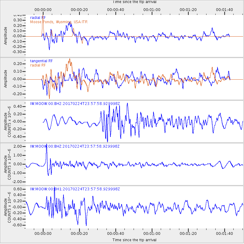
MOOW Moose Ponds, Wyoming, USA - Earthquake Result Viewer
*The percent match for this event was below the threshold and hence no stack was calculated.
| Earthquake location: |
Fiji Islands Region |
| Earthquake latitude/longitude: |
-18.0/-178.5 |
| Earthquake time(UTC): |
2017/02/24 (055) 23:46:45 GMT |
| Earthquake Depth: |
581 km |
| Earthquake Magnitude: |
5.9 Mww |
| Earthquake Catalog/Contributor: |
NEIC PDE/us |
|
| Network: |
IW Intermountain West |
| Station: |
MOOW Moose Ponds, Wyoming, USA |
| Lat/Lon: |
43.75 N/110.74 W |
| Elevation: |
2128 m |
|
| Distance: |
87.1 deg |
| Az: |
42.174 deg |
| Baz: |
241.863 deg |
| Ray Param: |
$rayparam |
*The percent match for this event was below the threshold and hence was not used in the summary stack. |
|
| Radial Match: |
59.231827 % |
| Radial Bump: |
400 |
| Transverse Match: |
65.74756 % |
| Transverse Bump: |
400 |
| SOD ConfigId: |
1992691 |
| Insert Time: |
2017-03-10 23:49:37.232 +0000 |
| GWidth: |
2.5 |
| Max Bumps: |
400 |
| Tol: |
0.001 |
|
Signal To Noise
| Channel | StoN | STA | LTA |
| IW:MOOW:00:BHZ:20170224T23:57:58.929998Z | 5.4430537 | 8.197825E-7 | 1.5061076E-7 |
| IW:MOOW:00:BH1:20170224T23:57:58.929998Z | 1.4800498 | 1.7348822E-7 | 1.1721782E-7 |
| IW:MOOW:00:BH2:20170224T23:57:58.929998Z | 2.1505868 | 1.801396E-7 | 8.3763E-8 |
| Arrivals |
| Ps | |
| PpPs | |
| PsPs/PpSs | |


