You are here: Home > Network List > II - Global Seismograph Network (GSN - IRIS/IDA) Stations List
> Station WRAB Tennant Creek, NT, Australia > Earthquake Result Viewer
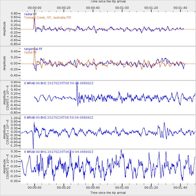
WRAB Tennant Creek, NT, Australia - Earthquake Result Viewer
*The percent match for this event was below the threshold and hence no stack was calculated.
| Earthquake location: |
Vanuatu Islands |
| Earthquake latitude/longitude: |
-18.5/169.4 |
| Earthquake time(UTC): |
2017/02/26 (057) 06:44:21 GMT |
| Earthquake Depth: |
244 km |
| Earthquake Magnitude: |
5.5 mb |
| Earthquake Catalog/Contributor: |
NEIC PDE/us |
|
| Network: |
II Global Seismograph Network (GSN - IRIS/IDA) |
| Station: |
WRAB Tennant Creek, NT, Australia |
| Lat/Lon: |
19.93 S/134.36 E |
| Elevation: |
366 m |
|
| Distance: |
33.1 deg |
| Az: |
261.751 deg |
| Baz: |
93.546 deg |
| Ray Param: |
$rayparam |
*The percent match for this event was below the threshold and hence was not used in the summary stack. |
|
| Radial Match: |
68.32322 % |
| Radial Bump: |
400 |
| Transverse Match: |
60.017467 % |
| Transverse Bump: |
400 |
| SOD ConfigId: |
1992691 |
| Insert Time: |
2017-03-12 06:46:05.747 +0000 |
| GWidth: |
2.5 |
| Max Bumps: |
400 |
| Tol: |
0.001 |
|
Signal To Noise
| Channel | StoN | STA | LTA |
| II:WRAB:00:BHZ:20170226T06:50:04.068992Z | 4.7401357 | 4.3224026E-7 | 9.118731E-8 |
| II:WRAB:00:BH1:20170226T06:50:04.068992Z | 1.0136497 | 1.08843764E-7 | 1.0737809E-7 |
| II:WRAB:00:BH2:20170226T06:50:04.068992Z | 2.9380522 | 2.4345715E-7 | 8.286345E-8 |
| Arrivals |
| Ps | |
| PpPs | |
| PsPs/PpSs | |


