You are here: Home > Network List > TA - USArray Transportable Network (new EarthScope stations) Stations List
> Station B18K Kokolik River, AK, USA > Earthquake Result Viewer
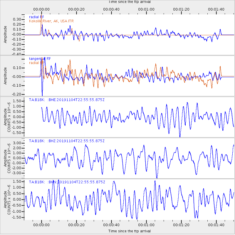
B18K Kokolik River, AK, USA - Earthquake Result Viewer
*The percent match for this event was below the threshold and hence no stack was calculated.
| Earthquake location: |
Tonga Islands |
| Earthquake latitude/longitude: |
-18.4/-175.2 |
| Earthquake time(UTC): |
2019/11/04 (308) 22:43:37 GMT |
| Earthquake Depth: |
10 km |
| Earthquake Magnitude: |
6.9 Mi |
| Earthquake Catalog/Contributor: |
NEIC PDE/at |
|
| Network: |
TA USArray Transportable Network (new EarthScope stations) |
| Station: |
B18K Kokolik River, AK, USA |
| Lat/Lon: |
69.36 N/161.80 W |
| Elevation: |
222 m |
|
| Distance: |
88.0 deg |
| Az: |
4.715 deg |
| Baz: |
192.718 deg |
| Ray Param: |
$rayparam |
*The percent match for this event was below the threshold and hence was not used in the summary stack. |
|
| Radial Match: |
50.222137 % |
| Radial Bump: |
400 |
| Transverse Match: |
58.066532 % |
| Transverse Bump: |
400 |
| SOD ConfigId: |
19951751 |
| Insert Time: |
2019-11-18 22:58:44.037 +0000 |
| GWidth: |
2.5 |
| Max Bumps: |
400 |
| Tol: |
0.001 |
|
Signal To Noise
| Channel | StoN | STA | LTA |
| TA:B18K: :BHZ:20191104T22:55:55.875Z | 2.3000062 | 1.1369069E-6 | 4.9430605E-7 |
| TA:B18K: :BHN:20191104T22:55:55.875Z | 1.1720393 | 5.2784156E-7 | 4.5036168E-7 |
| TA:B18K: :BHE:20191104T22:55:55.875Z | 0.76379347 | 3.6283146E-7 | 4.7503872E-7 |
| Arrivals |
| Ps | |
| PpPs | |
| PsPs/PpSs | |


