You are here: Home > Network List > TA - USArray Transportable Network (new EarthScope stations) Stations List
> Station E20K Nigu River, AK, USA > Earthquake Result Viewer
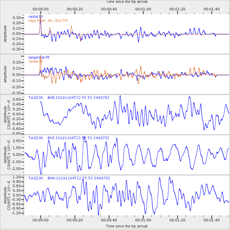
E20K Nigu River, AK, USA - Earthquake Result Viewer
*The percent match for this event was below the threshold and hence no stack was calculated.
| Earthquake location: |
Tonga Islands |
| Earthquake latitude/longitude: |
-18.4/-175.2 |
| Earthquake time(UTC): |
2019/11/04 (308) 22:43:37 GMT |
| Earthquake Depth: |
10 km |
| Earthquake Magnitude: |
6.9 Mi |
| Earthquake Catalog/Contributor: |
NEIC PDE/at |
|
| Network: |
TA USArray Transportable Network (new EarthScope stations) |
| Station: |
E20K Nigu River, AK, USA |
| Lat/Lon: |
68.26 N/156.19 W |
| Elevation: |
866 m |
|
| Distance: |
87.5 deg |
| Az: |
6.978 deg |
| Baz: |
198.035 deg |
| Ray Param: |
$rayparam |
*The percent match for this event was below the threshold and hence was not used in the summary stack. |
|
| Radial Match: |
78.89344 % |
| Radial Bump: |
400 |
| Transverse Match: |
85.52718 % |
| Transverse Bump: |
400 |
| SOD ConfigId: |
19951751 |
| Insert Time: |
2019-11-18 22:58:57.019 +0000 |
| GWidth: |
2.5 |
| Max Bumps: |
400 |
| Tol: |
0.001 |
|
Signal To Noise
| Channel | StoN | STA | LTA |
| TA:E20K: :BHZ:20191104T22:55:53.349976Z | 4.2831616 | 1.5464192E-6 | 3.6104618E-7 |
| TA:E20K: :BHN:20191104T22:55:53.349976Z | 1.964003 | 3.182871E-7 | 1.620604E-7 |
| TA:E20K: :BHE:20191104T22:55:53.349976Z | 1.1950939 | 3.4345283E-7 | 2.8738563E-7 |
| Arrivals |
| Ps | |
| PpPs | |
| PsPs/PpSs | |


