You are here: Home > Network List > TS - TERRAscope (Southern California Seismic Network) Stations List
> Station PAS Pasadena, California, USA > Earthquake Result Viewer
PAS Pasadena, California, USA - Earthquake Result Viewer

| Earthquake location: |
Mariana Islands Region |
| Earthquake latitude/longitude: |
21.6/143.0 |
| Earthquake time(UTC): |
2001/07/03 (184) 13:10:42 GMT |
| Earthquake Depth: |
290 km |
| Earthquake Magnitude: |
6.0 MB, 6.5 MW, 6.5 MW |
| Earthquake Catalog/Contributor: |
WHDF/NEIC |
|
| Network: |
TS TERRAscope (Southern California Seismic Network) |
| Station: |
PAS Pasadena, California, USA |
| Lat/Lon: |
34.15 N/118.17 W |
| Elevation: |
295 m |
|
| Distance: |
85.1 deg |
| Az: |
55.339 deg |
| Baz: |
292.671 deg |
| Ray Param: |
0.04431529 |
| Estimated Moho Depth: |
26.0 km |
| Estimated Crust Vp/Vs: |
1.81 |
| Assumed Crust Vp: |
6.1 km/s |
| Estimated Crust Vs: |
3.366 km/s |
| Estimated Crust Poisson's Ratio: |
0.28 |
|
| Radial Match: |
84.7851 % |
| Radial Bump: |
400 |
| Transverse Match: |
83.59041 % |
| Transverse Bump: |
400 |
| SOD ConfigId: |
4714 |
| Insert Time: |
2010-02-26 14:33:12.620 +0000 |
| GWidth: |
2.5 |
| Max Bumps: |
400 |
| Tol: |
0.001 |
|
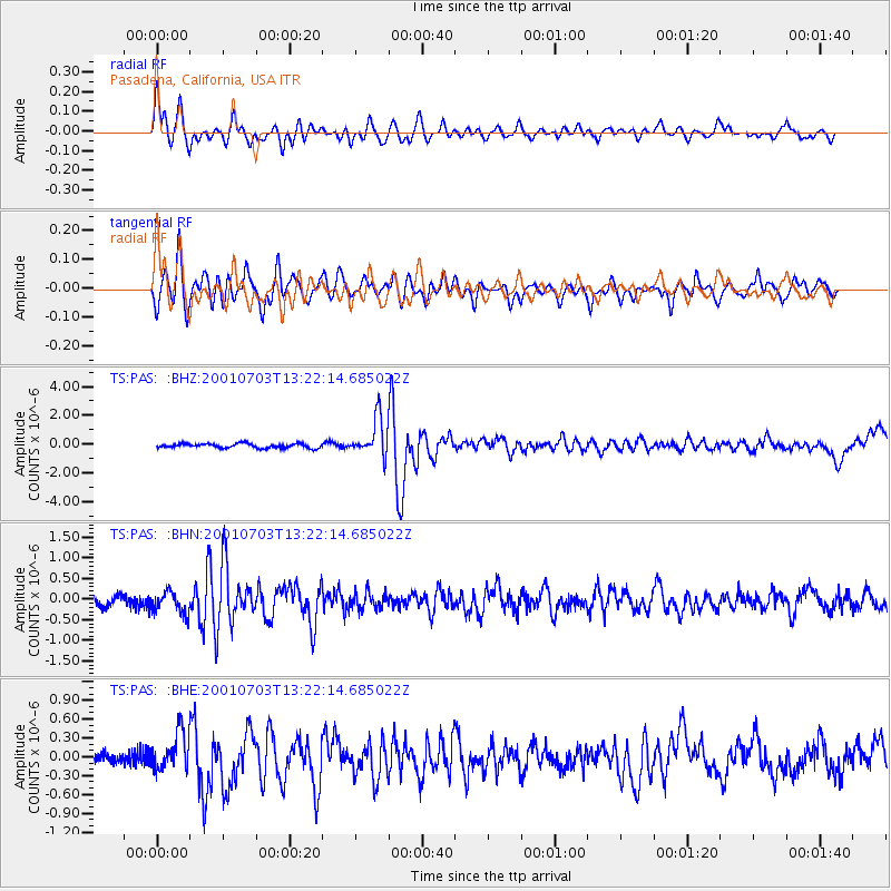
Signal To Noise
| Channel | StoN | STA | LTA |
| TS:PAS: :BHN:20010703T13:22:14.685022Z | 2.2181308 | 2.6451042E-7 | 1.1924925E-7 |
| TS:PAS: :BHE:20010703T13:22:14.685022Z | 3.3968701 | 3.092211E-7 | 9.103118E-8 |
| TS:PAS: :BHZ:20010703T13:22:14.685022Z | 8.538044 | 1.3214749E-6 | 1.547749E-7 |
| Arrivals |
| Ps | 3.5 SECOND |
| PpPs | 12 SECOND |
| PsPs/PpSs | 15 SECOND |


