Y26A Elida, NM, USA - Earthquake Result Viewer
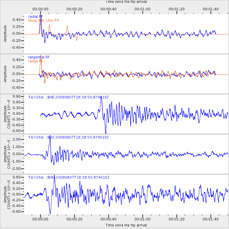
Earthquake location: Andreanof Islands, Aleutian Is.
Earthquake latitude/longitude: 52.2/-175.7
Earthquake time(UTC): 2008/08/07 (220) 18:30:03 GMT
Earthquake Depth: 12 km
Earthquake Magnitude: 5.6 MB, 5.5 MS, 5.8 MW, 5.8 MW
Earthquake Catalog/Contributor: WHDF/NEIC
Network: TA USArray Transportable Network (new EarthScope stations)
Station: Y26A Elida, NM, USA
Lat/Lon: 33.92 N/103.82 W
Elevation: 1371 m
Distance: 53.3 deg
Az: 80.12 deg
Baz: 313.166 deg
Ray Param: 0.06617764
Estimated Moho Depth: 14.25 km
Estimated Crust Vp/Vs: 1.82
Assumed Crust Vp: 6.129 km/s
Estimated Crust Vs: 3.368 km/s
Estimated Crust Poisson's Ratio: 0.28
Radial Match: 84.47256 %
Radial Bump: 400
Transverse Match: 70.3217 %
Transverse Bump: 400
SOD ConfigId: 2504
Insert Time: 2010-03-07 05:34:03.350 +0000
GWidth: 2.5
Max Bumps: 400
Tol: 0.001

Signal To Noise

ChannelStoNSTALTA
TA:Y26A: :BHZ:20080807T18:38:50.874016Z4.52465773.413755E-77.5447815E-8
TA:Y26A: :BHN:20080807T18:38:50.874016Z1.98943131.17920536E-75.927349E-8
TA:Y26A: :BHE:20080807T18:38:50.874016Z1.64627041.3587461E-78.253481E-8
Arrivals
Ps2.0 SECOND
PpPs6.3 SECOND
PsPs/PpSs8.3 SECOND