
Y26A Elida, NM, USA - Earthquake Result Viewer
| ||||||||||||||||||
| ||||||||||||||||||
| ||||||||||||||||||
|
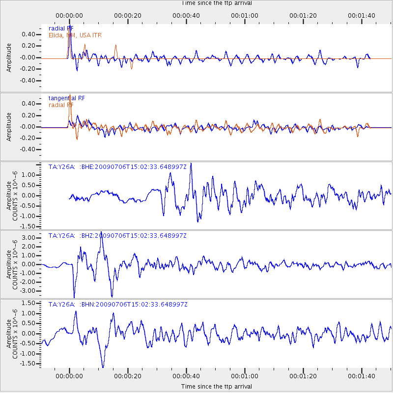
Signal To Noise
| Channel | StoN | STA | LTA |
| TA:Y26A: :BHZ:20090706T15:02:33.648997Z | 10.000209 | 1.3497805E-6 | 1.3497522E-7 |
| TA:Y26A: :BHN:20090706T15:02:33.648997Z | 2.1989834 | 4.724999E-7 | 2.1487196E-7 |
| TA:Y26A: :BHE:20090706T15:02:33.648997Z | 3.440687 | 5.711943E-7 | 1.6601169E-7 |
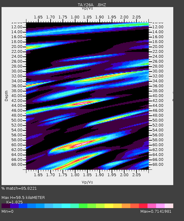
| Arrivals | |
| Ps | 8.4 SECOND |
| PpPs | 26 SECOND |
| PsPs/PpSs | 35 SECOND |

