You are here: Home > Network List > TA - USArray Transportable Network (new EarthScope stations) Stations List
> Station Y26A Elida, NM, USA > Earthquake Result Viewer
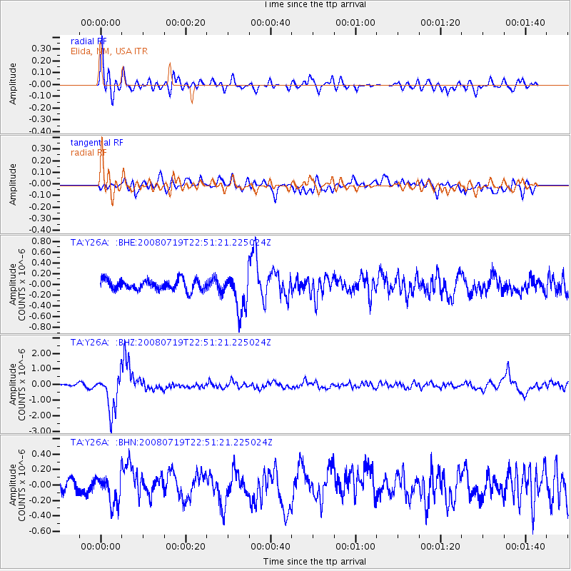
Y26A Elida, NM, USA - Earthquake Result Viewer
*The percent match for this event was below the threshold and hence no stack was calculated.
| Earthquake location: |
Fiji Islands Region |
| Earthquake latitude/longitude: |
-17.3/-177.3 |
| Earthquake time(UTC): |
2008/07/19 (201) 22:39:52 GMT |
| Earthquake Depth: |
391 km |
| Earthquake Magnitude: |
5.9 MB, 6.4 MW, 6.4 MW |
| Earthquake Catalog/Contributor: |
WHDF/NEIC |
|
| Network: |
TA USArray Transportable Network (new EarthScope stations) |
| Station: |
Y26A Elida, NM, USA |
| Lat/Lon: |
33.92 N/103.82 W |
| Elevation: |
1371 m |
|
| Distance: |
86.5 deg |
| Az: |
53.008 deg |
| Baz: |
246.558 deg |
| Ray Param: |
$rayparam |
*The percent match for this event was below the threshold and hence was not used in the summary stack. |
|
| Radial Match: |
74.27654 % |
| Radial Bump: |
400 |
| Transverse Match: |
63.92179 % |
| Transverse Bump: |
400 |
| SOD ConfigId: |
2504 |
| Insert Time: |
2010-03-07 05:35:23.932 +0000 |
| GWidth: |
2.5 |
| Max Bumps: |
400 |
| Tol: |
0.001 |
|
Signal To Noise
| Channel | StoN | STA | LTA |
| TA:Y26A: :BHZ:20080719T22:51:21.225024Z | 8.009869 | 1.2223213E-6 | 1.5260191E-7 |
| TA:Y26A: :BHN:20080719T22:51:21.225024Z | 1.3782223 | 1.8272534E-7 | 1.3258047E-7 |
| TA:Y26A: :BHE:20080719T22:51:21.225024Z | 3.6567874 | 3.579865E-7 | 9.789645E-8 |
| Arrivals |
| Ps | |
| PpPs | |
| PsPs/PpSs | |


