You are here: Home > Network List > TA - USArray Transportable Network (new EarthScope stations) Stations List
> Station Y26A Elida, NM, USA > Earthquake Result Viewer
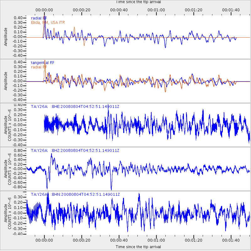
Y26A Elida, NM, USA - Earthquake Result Viewer
*The percent match for this event was below the threshold and hence no stack was calculated.
| Earthquake location: |
Kuril Islands |
| Earthquake latitude/longitude: |
49.9/156.4 |
| Earthquake time(UTC): |
2008/08/04 (217) 04:42:14 GMT |
| Earthquake Depth: |
77 km |
| Earthquake Magnitude: |
5.6 MB, 5.8 MW, 5.7 MW |
| Earthquake Catalog/Contributor: |
WHDF/NEIC |
|
| Network: |
TA USArray Transportable Network (new EarthScope stations) |
| Station: |
Y26A Elida, NM, USA |
| Lat/Lon: |
33.92 N/103.82 W |
| Elevation: |
1371 m |
|
| Distance: |
70.6 deg |
| Az: |
60.298 deg |
| Baz: |
317.455 deg |
| Ray Param: |
$rayparam |
*The percent match for this event was below the threshold and hence was not used in the summary stack. |
|
| Radial Match: |
72.932365 % |
| Radial Bump: |
400 |
| Transverse Match: |
62.703316 % |
| Transverse Bump: |
400 |
| SOD ConfigId: |
2504 |
| Insert Time: |
2010-03-07 05:35:25.913 +0000 |
| GWidth: |
2.5 |
| Max Bumps: |
400 |
| Tol: |
0.001 |
|
Signal To Noise
| Channel | StoN | STA | LTA |
| TA:Y26A: :BHZ:20080804T04:52:51.149011Z | 6.766338 | 3.8065386E-7 | 5.6256997E-8 |
| TA:Y26A: :BHN:20080804T04:52:51.149011Z | 1.9291358 | 1.6171559E-7 | 8.3828E-8 |
| TA:Y26A: :BHE:20080804T04:52:51.149011Z | 1.3784332 | 1.2670476E-7 | 9.1919404E-8 |
| Arrivals |
| Ps | |
| PpPs | |
| PsPs/PpSs | |


