You are here: Home > Network List > TA - USArray Transportable Network (new EarthScope stations) Stations List
> Station Y26A Elida, NM, USA > Earthquake Result Viewer
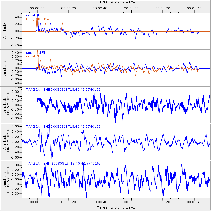
Y26A Elida, NM, USA - Earthquake Result Viewer
*The percent match for this event was below the threshold and hence no stack was calculated.
| Earthquake location: |
North Of Severnaya Zemlya |
| Earthquake latitude/longitude: |
83.6/114.5 |
| Earthquake time(UTC): |
2008/08/13 (226) 18:30:57 GMT |
| Earthquake Depth: |
10 km |
| Earthquake Magnitude: |
5.7 MW, 5.2 MS, 5.3 MB, 5.7 MW |
| Earthquake Catalog/Contributor: |
WHDF/NEIC |
|
| Network: |
TA USArray Transportable Network (new EarthScope stations) |
| Station: |
Y26A Elida, NM, USA |
| Lat/Lon: |
33.92 N/103.82 W |
| Elevation: |
1371 m |
|
| Distance: |
61.4 deg |
| Az: |
35.967 deg |
| Baz: |
355.419 deg |
| Ray Param: |
$rayparam |
*The percent match for this event was below the threshold and hence was not used in the summary stack. |
|
| Radial Match: |
54.310917 % |
| Radial Bump: |
400 |
| Transverse Match: |
48.616844 % |
| Transverse Bump: |
400 |
| SOD ConfigId: |
2504 |
| Insert Time: |
2010-03-07 05:35:28.301 +0000 |
| GWidth: |
2.5 |
| Max Bumps: |
400 |
| Tol: |
0.001 |
|
Signal To Noise
| Channel | StoN | STA | LTA |
| TA:Y26A: :BHZ:20080813T18:40:42.574016Z | 3.232069 | 2.9114014E-7 | 9.0078565E-8 |
| TA:Y26A: :BHN:20080813T18:40:42.574016Z | 1.2815549 | 1.441762E-7 | 1.1250099E-7 |
| TA:Y26A: :BHE:20080813T18:40:42.574016Z | 1.1714152 | 9.8759344E-8 | 8.430772E-8 |
| Arrivals |
| Ps | |
| PpPs | |
| PsPs/PpSs | |


