You are here: Home > Network List > TA - USArray Transportable Network (new EarthScope stations) Stations List
> Station Y26A Elida, NM, USA > Earthquake Result Viewer
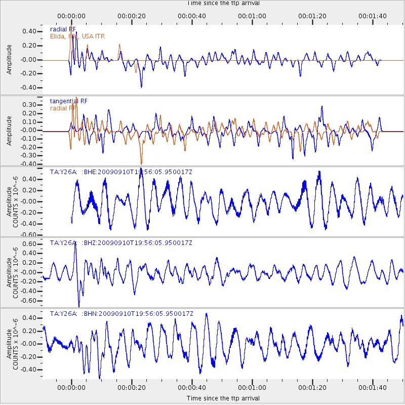
Y26A Elida, NM, USA - Earthquake Result Viewer
*The percent match for this event was below the threshold and hence no stack was calculated.
| Earthquake location: |
Easter Island Region |
| Earthquake latitude/longitude: |
-29.9/-111.8 |
| Earthquake time(UTC): |
2009/09/10 (253) 19:46:03 GMT |
| Earthquake Depth: |
10 km |
| Earthquake Magnitude: |
5.5 MW, 5.4 MB |
| Earthquake Catalog/Contributor: |
WHDF/NEIC |
|
| Network: |
TA USArray Transportable Network (new EarthScope stations) |
| Station: |
Y26A Elida, NM, USA |
| Lat/Lon: |
33.92 N/103.82 W |
| Elevation: |
1371 m |
|
| Distance: |
64.0 deg |
| Az: |
7.4 deg |
| Baz: |
187.728 deg |
| Ray Param: |
$rayparam |
*The percent match for this event was below the threshold and hence was not used in the summary stack. |
|
| Radial Match: |
61.30422 % |
| Radial Bump: |
400 |
| Transverse Match: |
49.93821 % |
| Transverse Bump: |
346 |
| SOD ConfigId: |
2622 |
| Insert Time: |
2010-03-07 05:35:48.830 +0000 |
| GWidth: |
2.5 |
| Max Bumps: |
400 |
| Tol: |
0.001 |
|
Signal To Noise
| Channel | StoN | STA | LTA |
| TA:Y26A: :BHZ:20090910T19:56:05.950017Z | 1.9096233 | 3.3778116E-7 | 1.7688366E-7 |
| TA:Y26A: :BHN:20090910T19:56:05.950017Z | 1.1785307 | 1.6983319E-7 | 1.4410587E-7 |
| TA:Y26A: :BHE:20090910T19:56:05.950017Z | 0.76040953 | 1.8278675E-7 | 2.4037936E-7 |
| Arrivals |
| Ps | |
| PpPs | |
| PsPs/PpSs | |


