You are here: Home > Network List > TA - USArray Transportable Network (new EarthScope stations) Stations List
> Station Y26A Elida, NM, USA > Earthquake Result Viewer
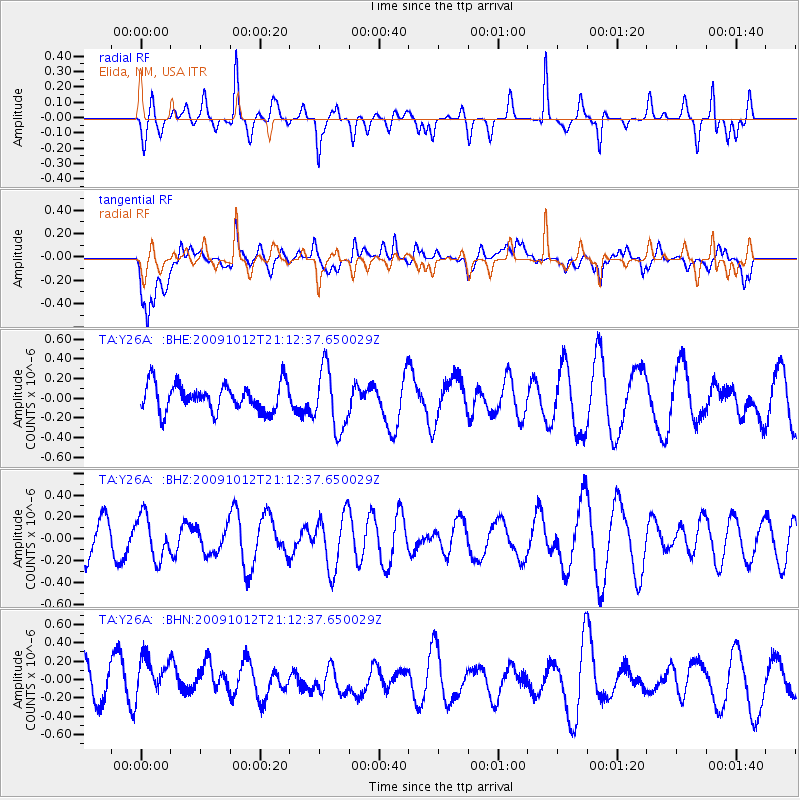
Y26A Elida, NM, USA - Earthquake Result Viewer
*The percent match for this event was below the threshold and hence no stack was calculated.
| Earthquake location: |
Vanuatu Islands |
| Earthquake latitude/longitude: |
-14.1/166.3 |
| Earthquake time(UTC): |
2009/10/12 (285) 20:59:38 GMT |
| Earthquake Depth: |
35 km |
| Earthquake Magnitude: |
5.7 MW, 5.4 MS, 5.2 MB, 5.7 MW |
| Earthquake Catalog/Contributor: |
WHDF/NEIC |
|
| Network: |
TA USArray Transportable Network (new EarthScope stations) |
| Station: |
Y26A Elida, NM, USA |
| Lat/Lon: |
33.92 N/103.82 W |
| Elevation: |
1371 m |
|
| Distance: |
97.7 deg |
| Az: |
57.033 deg |
| Baz: |
258.259 deg |
| Ray Param: |
$rayparam |
*The percent match for this event was below the threshold and hence was not used in the summary stack. |
|
| Radial Match: |
50.002506 % |
| Radial Bump: |
319 |
| Transverse Match: |
49.52462 % |
| Transverse Bump: |
400 |
| SOD ConfigId: |
2622 |
| Insert Time: |
2010-03-07 05:35:58.253 +0000 |
| GWidth: |
2.5 |
| Max Bumps: |
400 |
| Tol: |
0.001 |
|
Signal To Noise
| Channel | StoN | STA | LTA |
| TA:Y26A: :BHZ:20091012T21:12:37.650029Z | 0.7017245 | 1.9791437E-7 | 2.8204E-7 |
| TA:Y26A: :BHN:20091012T21:12:37.650029Z | 1.3677557 | 2.5119013E-7 | 1.8365131E-7 |
| TA:Y26A: :BHE:20091012T21:12:37.650029Z | 2.274112 | 3.146279E-7 | 1.3835198E-7 |
| Arrivals |
| Ps | |
| PpPs | |
| PsPs/PpSs | |


