You are here: Home > Network List > TA - USArray Transportable Network (new EarthScope stations) Stations List
> Station Y26A Elida, NM, USA > Earthquake Result Viewer
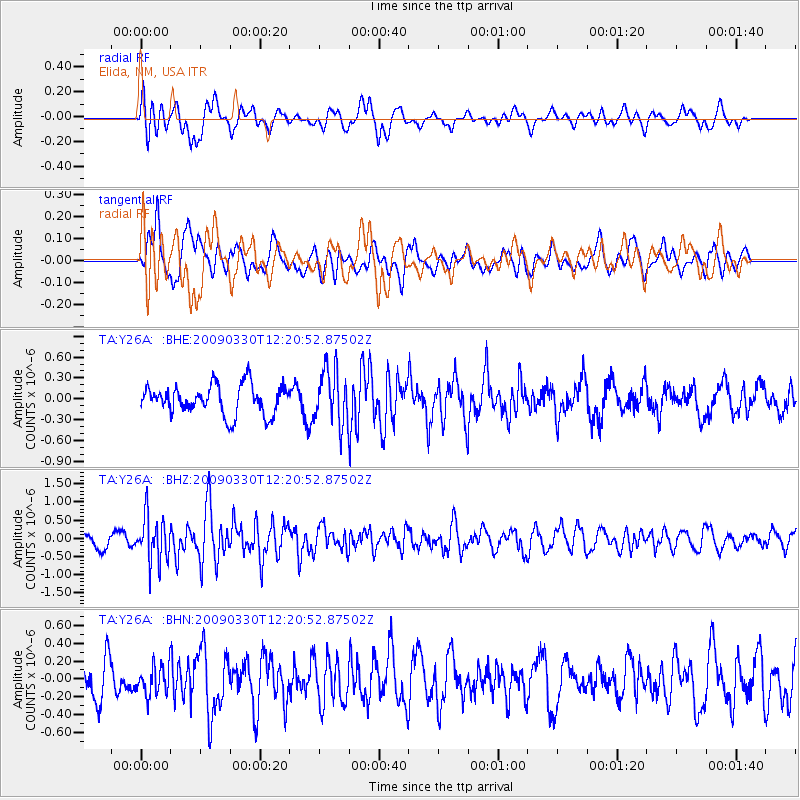
Y26A Elida, NM, USA - Earthquake Result Viewer
*The percent match for this event was below the threshold and hence no stack was calculated.
| Earthquake location: |
Andreanof Islands, Aleutian Is. |
| Earthquake latitude/longitude: |
51.5/-178.3 |
| Earthquake time(UTC): |
2009/03/30 (089) 12:11:54 GMT |
| Earthquake Depth: |
31 km |
| Earthquake Magnitude: |
6.0 MB, 5.8 MW, 5.7 MW |
| Earthquake Catalog/Contributor: |
WHDF/NEIC |
|
| Network: |
TA USArray Transportable Network (new EarthScope stations) |
| Station: |
Y26A Elida, NM, USA |
| Lat/Lon: |
33.92 N/103.82 W |
| Elevation: |
1371 m |
|
| Distance: |
55.0 deg |
| Az: |
77.821 deg |
| Baz: |
312.744 deg |
| Ray Param: |
$rayparam |
*The percent match for this event was below the threshold and hence was not used in the summary stack. |
|
| Radial Match: |
56.450237 % |
| Radial Bump: |
400 |
| Transverse Match: |
48.817116 % |
| Transverse Bump: |
400 |
| SOD ConfigId: |
2658 |
| Insert Time: |
2010-03-07 05:36:21.320 +0000 |
| GWidth: |
2.5 |
| Max Bumps: |
400 |
| Tol: |
0.001 |
|
Signal To Noise
| Channel | StoN | STA | LTA |
| TA:Y26A: :BHZ:20090330T12:20:52.87502Z | 4.1986313 | 6.288682E-7 | 1.4977934E-7 |
| TA:Y26A: :BHN:20090330T12:20:52.87502Z | 0.83050567 | 1.628402E-7 | 1.9607356E-7 |
| TA:Y26A: :BHE:20090330T12:20:52.87502Z | 1.8502734 | 3.9178184E-7 | 2.1174267E-7 |
| Arrivals |
| Ps | |
| PpPs | |
| PsPs/PpSs | |


