You are here: Home > Network List > TA - USArray Transportable Network (new EarthScope stations) Stations List
> Station Y26A Elida, NM, USA > Earthquake Result Viewer
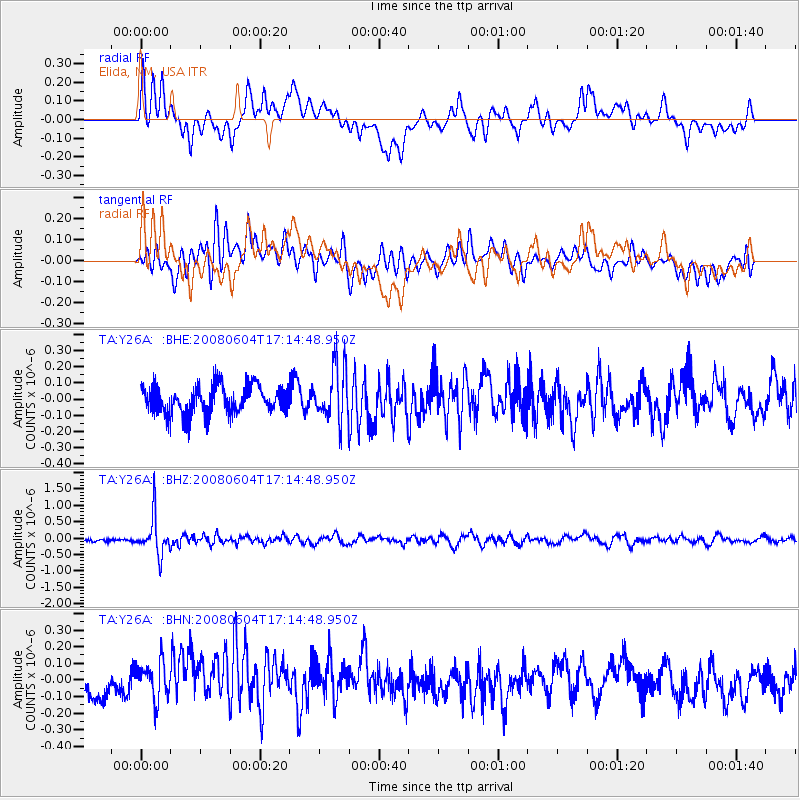
Y26A Elida, NM, USA - Earthquake Result Viewer
*The percent match for this event was below the threshold and hence no stack was calculated.
| Earthquake location: |
Hokkaido, Japan Region |
| Earthquake latitude/longitude: |
41.5/139.0 |
| Earthquake time(UTC): |
2008/06/04 (156) 17:03:07 GMT |
| Earthquake Depth: |
213 km |
| Earthquake Magnitude: |
5.5 MB, 5.7 MW, 5.7 MW |
| Earthquake Catalog/Contributor: |
WHDF/NEIC |
|
| Network: |
TA USArray Transportable Network (new EarthScope stations) |
| Station: |
Y26A Elida, NM, USA |
| Lat/Lon: |
33.92 N/103.82 W |
| Elevation: |
1371 m |
|
| Distance: |
85.3 deg |
| Az: |
47.95 deg |
| Baz: |
317.898 deg |
| Ray Param: |
$rayparam |
*The percent match for this event was below the threshold and hence was not used in the summary stack. |
|
| Radial Match: |
58.940388 % |
| Radial Bump: |
400 |
| Transverse Match: |
55.427525 % |
| Transverse Bump: |
400 |
| SOD ConfigId: |
2504 |
| Insert Time: |
2010-03-07 05:36:41.258 +0000 |
| GWidth: |
2.5 |
| Max Bumps: |
400 |
| Tol: |
0.001 |
|
Signal To Noise
| Channel | StoN | STA | LTA |
| TA:Y26A: :BHZ:20080604T17:14:48.950Z | 10.279749 | 5.8489456E-7 | 5.6897754E-8 |
| TA:Y26A: :BHN:20080604T17:14:48.950Z | 1.8661188 | 1.2635273E-7 | 6.770884E-8 |
| TA:Y26A: :BHE:20080604T17:14:48.950Z | 1.9504892 | 1.6819955E-7 | 8.623454E-8 |
| Arrivals |
| Ps | |
| PpPs | |
| PsPs/PpSs | |


