You are here: Home > Network List > WY - Yellowstone Wyoming Seismic Network Stations List
> Station YHR Hawk's Rest, WY, USA > Earthquake Result Viewer
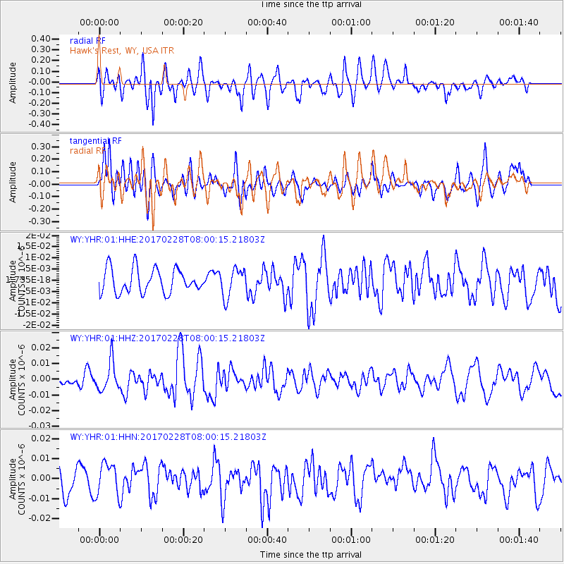
YHR Hawk's Rest, WY, USA - Earthquake Result Viewer
*The percent match for this event was below the threshold and hence no stack was calculated.
| Earthquake location: |
Near East Coast Of Honshu, Japan |
| Earthquake latitude/longitude: |
37.6/141.3 |
| Earthquake time(UTC): |
2017/02/28 (059) 07:49:01 GMT |
| Earthquake Depth: |
38 km |
| Earthquake Magnitude: |
5.7 Mww |
| Earthquake Catalog/Contributor: |
NEIC PDE/us |
|
| Network: |
WY Yellowstone Wyoming Seismic Network |
| Station: |
YHR Hawk's Rest, WY, USA |
| Lat/Lon: |
44.11 N/110.08 W |
| Elevation: |
2976 m |
|
| Distance: |
76.2 deg |
| Az: |
44.663 deg |
| Baz: |
309.162 deg |
| Ray Param: |
$rayparam |
*The percent match for this event was below the threshold and hence was not used in the summary stack. |
|
| Radial Match: |
53.94377 % |
| Radial Bump: |
400 |
| Transverse Match: |
56.739162 % |
| Transverse Bump: |
400 |
| SOD ConfigId: |
1992691 |
| Insert Time: |
2017-03-14 07:56:34.620 +0000 |
| GWidth: |
2.5 |
| Max Bumps: |
400 |
| Tol: |
0.001 |
|
Signal To Noise
| Channel | StoN | STA | LTA |
| WY:YHR:01:HHZ:20170228T08:00:15.21803Z | 3.12885 | 9.54142E-9 | 3.0494975E-9 |
| WY:YHR:01:HHN:20170228T08:00:15.21803Z | 1.5660267 | 8.0403595E-9 | 5.1342415E-9 |
| WY:YHR:01:HHE:20170228T08:00:15.21803Z | 1.2225379 | 6.565542E-9 | 5.3704197E-9 |
| Arrivals |
| Ps | |
| PpPs | |
| PsPs/PpSs | |


