L24A Wheatland, WY, USA - Earthquake Result Viewer
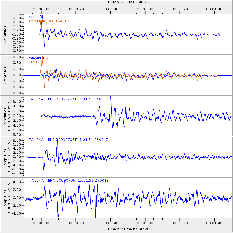
Earthquake location: Rat Islands, Aleutian Islands
Earthquake latitude/longitude: 50.4/177.0
Earthquake time(UTC): 2009/07/06 (187) 14:53:12 GMT
Earthquake Depth: 22 km
Earthquake Magnitude: 6.0 MB, 5.8 MS, 6.1 MW, 6.0 MW
Earthquake Catalog/Contributor: WHDF/NEIC
Network: TA USArray Transportable Network (new EarthScope stations)
Station: L24A Wheatland, WY, USA
Lat/Lon: 42.04 N/104.93 W
Elevation: 1479 m
Distance: 52.3 deg
Az: 67.067 deg
Baz: 307.752 deg
Ray Param: 0.06681057
Estimated Moho Depth: 61.5 km
Estimated Crust Vp/Vs: 1.73
Assumed Crust Vp: 6.159 km/s
Estimated Crust Vs: 3.57 km/s
Estimated Crust Poisson's Ratio: 0.25
Radial Match: 93.92182 %
Radial Bump: 396
Transverse Match: 91.477135 %
Transverse Bump: 400
SOD ConfigId: 2648
Insert Time: 2010-03-07 05:38:22.990 +0000
GWidth: 2.5
Max Bumps: 400
Tol: 0.001

Signal To Noise

ChannelStoNSTALTA
TA:L24A: :BHZ:20090706T15:01:51.25001Z13.3486812.5211032E-61.8886533E-7
TA:L24A: :BHN:20090706T15:01:51.25001Z6.35919051.4718731E-62.3145606E-7
TA:L24A: :BHE:20090706T15:01:51.25001Z8.9019011.9014058E-62.1359546E-7
Arrivals
Ps7.6 SECOND
PpPs26 SECOND
PsPs/PpSs33 SECOND