You are here: Home > Network List > TX - Texas Seismological Network Stations List
> Station WTFS Witchita Falls > Earthquake Result Viewer
WTFS Witchita Falls - Earthquake Result Viewer
*The percent match for this event was below the threshold and hence no stack was calculated.
| Earthquake location: |
Off Coast Of Southern Chile |
| Earthquake latitude/longitude: |
-44.8/-80.9 |
| Earthquake time(UTC): |
2017/02/28 (059) 17:35:40 GMT |
| Earthquake Depth: |
10 km |
| Earthquake Magnitude: |
5.6 Mww |
| Earthquake Catalog/Contributor: |
NEIC PDE/us |
|
| Network: |
TX Texas Seismological Network |
| Station: |
WTFS Witchita Falls |
| Lat/Lon: |
33.77 N/98.46 W |
| Elevation: |
277 m |
|
| Distance: |
79.8 deg |
| Az: |
345.215 deg |
| Baz: |
167.395 deg |
| Ray Param: |
$rayparam |
*The percent match for this event was below the threshold and hence was not used in the summary stack. |
|
| Radial Match: |
56.75423 % |
| Radial Bump: |
400 |
| Transverse Match: |
49.723454 % |
| Transverse Bump: |
400 |
| SOD ConfigId: |
1992691 |
| Insert Time: |
2017-03-14 17:40:49.492 +0000 |
| GWidth: |
2.5 |
| Max Bumps: |
400 |
| Tol: |
0.001 |
|
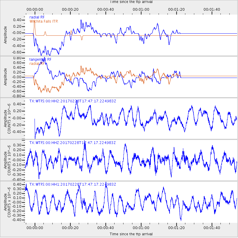
Signal To Noise
| Channel | StoN | STA | LTA |
| TX:WTFS:00:HHZ:20170228T17:47:17.224983Z | 1.0261953 | 1.61089E-7 | 1.5697694E-7 |
| TX:WTFS:00:HH1:20170228T17:47:17.224983Z | 0.87798387 | 1.6305543E-7 | 1.8571575E-7 |
| TX:WTFS:00:HH2:20170228T17:47:17.224983Z | 0.934033 | 2.4025792E-7 | 2.572264E-7 |
| Arrivals |
| Ps | |
| PpPs | |
| PsPs/PpSs | |


