PAS Pasadena, California, USA - Earthquake Result Viewer
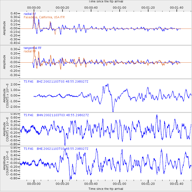
Earthquake location: Near East Coast Of Honshu, Japan
Earthquake latitude/longitude: 38.9/142.0
Earthquake time(UTC): 2002/11/03 (307) 03:37:42 GMT
Earthquake Depth: 39 km
Earthquake Magnitude: 5.7 MB, 6.1 MS, 6.4 MW, 6.4 MW
Earthquake Catalog/Contributor: WHDF/NEIC
Network: TS TERRAscope (Southern California Seismic Network)
Station: PAS Pasadena, California, USA
Lat/Lon: 34.15 N/118.17 W
Elevation: 295 m
Distance: 76.2 deg
Az: 57.289 deg
Baz: 307.645 deg
Ray Param: 0.051094823
Estimated Moho Depth: 26.75 km
Estimated Crust Vp/Vs: 1.78
Assumed Crust Vp: 6.1 km/s
Estimated Crust Vs: 3.427 km/s
Estimated Crust Poisson's Ratio: 0.27
Radial Match: 90.9546 %
Radial Bump: 384
Transverse Match: 69.91798 %
Transverse Bump: 400
SOD ConfigId: 4714
Insert Time: 2010-02-26 14:33:40.147 +0000
GWidth: 2.5
Max Bumps: 400
Tol: 0.001

Signal To Noise

ChannelStoNSTALTA
TS:PAS: :BHN:20021103T03:48:55.298027Z1.94560681.5590739E-78.013304E-8
TS:PAS: :BHE:20021103T03:48:55.298027Z1.0464271.1825177E-71.1300527E-7
TS:PAS: :BHZ:20021103T03:48:55.298027Z1.86492372.7341235E-71.4660779E-7
Arrivals
Ps3.5 SECOND
PpPs12 SECOND
PsPs/PpSs15 SECOND