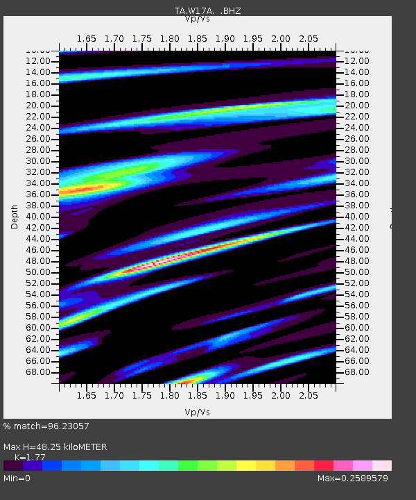
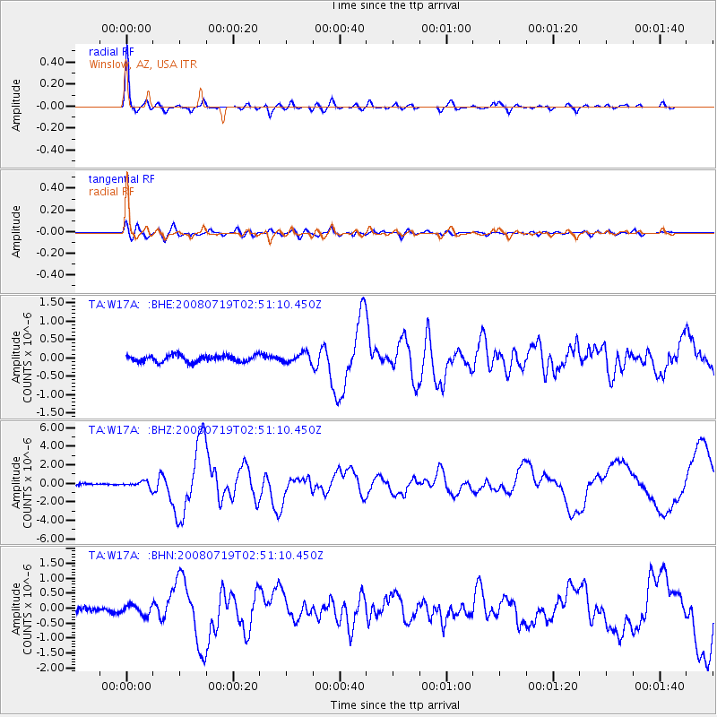
W17A Winslow, AZ, USA - Earthquake Result Viewer

Earthquake location: Off East Coast Of Honshu, Japan
Earthquake latitude/longitude: 37.6/142.2
Earthquake time(UTC): 2008/07/19 (201) 02:39:28 GMT
Earthquake Depth: 22 km
Earthquake Magnitude: 6.2 MB, 7.0 MS, 7.0 MW, 6.9 MW
Earthquake Catalog/Contributor: WHDF/NEIC
Network: TA USArray Transportable Network (new EarthScope stations)
Station: W17A Winslow, AZ, USA
Lat/Lon: 35.08 N/110.71 W
Elevation: 1461 m
Distance: 81.0 deg
Az: 52.535 deg
Baz: 309.723 deg
Ray Param: 0.047847822
Estimated Moho Depth: 48.25 km
Estimated Crust Vp/Vs: 1.77
Assumed Crust Vp: 6.207 km/s
Estimated Crust Vs: 3.507 km/s
Estimated Crust Poisson's Ratio: 0.27
Radial Match: 96.23057 %
Radial Bump: 307
Transverse Match: 86.25223 %
Transverse Bump: 400
SOD ConfigId: 2504
Insert Time: 2010-03-07 05:40:29.392 +0000
GWidth: 2.5
Max Bumps: 400
Tol: 0.001

Signal To Noise

ChannelStoNSTALTA
TA:W17A: :BHZ:20080719T02:51:10.450Z2.96631983.375516E-71.1379474E-7
TA:W17A: :BHN:20080719T02:51:10.450Z1.71811661.5822197E-79.209035E-8
TA:W17A: :BHE:20080719T02:51:10.450Z1.44027791.2992164E-79.020596E-8
Arrivals
Ps6.1 SECOND
PpPs21 SECOND
PsPs/PpSs27 SECOND