You are here: Home > Network List > CI - Caltech Regional Seismic Network Stations List
> Station MPP McPhearson Peak > Earthquake Result Viewer
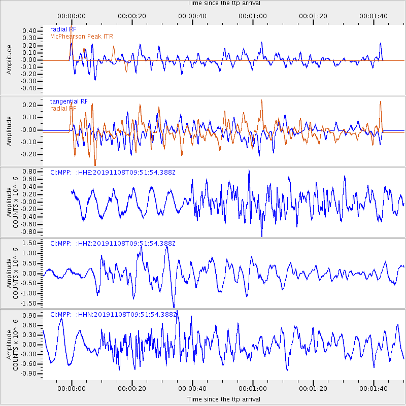
MPP McPhearson Peak - Earthquake Result Viewer
*The percent match for this event was below the threshold and hence no stack was calculated.
| Earthquake location: |
Samoa Islands Region |
| Earthquake latitude/longitude: |
-15.8/-172.6 |
| Earthquake time(UTC): |
2019/11/08 (312) 09:41:16 GMT |
| Earthquake Depth: |
80 km |
| Earthquake Magnitude: |
6.2 Mi |
| Earthquake Catalog/Contributor: |
NEIC PDE/pt |
|
| Network: |
CI Caltech Regional Seismic Network |
| Station: |
MPP McPhearson Peak |
| Lat/Lon: |
34.89 N/119.81 W |
| Elevation: |
1739 m |
|
| Distance: |
71.0 deg |
| Az: |
43.8 deg |
| Baz: |
234.162 deg |
| Ray Param: |
$rayparam |
*The percent match for this event was below the threshold and hence was not used in the summary stack. |
|
| Radial Match: |
57.873512 % |
| Radial Bump: |
400 |
| Transverse Match: |
52.287067 % |
| Transverse Bump: |
400 |
| SOD ConfigId: |
19951751 |
| Insert Time: |
2019-11-22 09:49:42.900 +0000 |
| GWidth: |
2.5 |
| Max Bumps: |
400 |
| Tol: |
0.001 |
|
Signal To Noise
| Channel | StoN | STA | LTA |
| CI:MPP: :HHZ:20191108T09:51:54.388Z | 0.5811149 | 1.3437788E-7 | 2.312415E-7 |
| CI:MPP: :HHN:20191108T09:51:54.388Z | 1.2918514 | 3.7074926E-7 | 2.8699063E-7 |
| CI:MPP: :HHE:20191108T09:51:54.388Z | 0.94186795 | 2.2907369E-7 | 2.4321213E-7 |
| Arrivals |
| Ps | |
| PpPs | |
| PsPs/PpSs | |


