You are here: Home > Network List > TA - USArray Transportable Network (new EarthScope stations) Stations List
> Station B18K Kokolik River, AK, USA > Earthquake Result Viewer
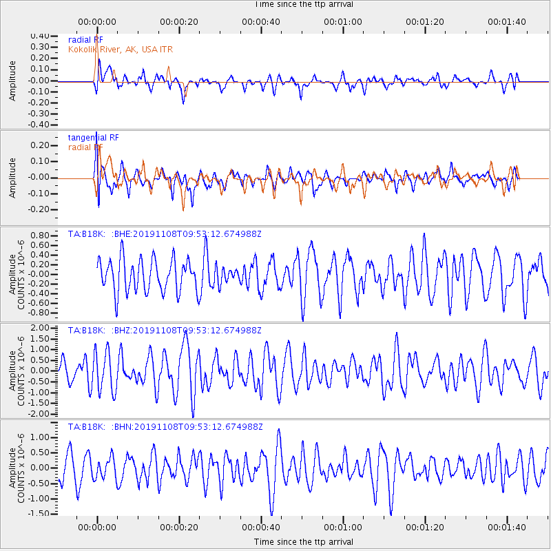
B18K Kokolik River, AK, USA - Earthquake Result Viewer
*The percent match for this event was below the threshold and hence no stack was calculated.
| Earthquake location: |
Samoa Islands Region |
| Earthquake latitude/longitude: |
-15.8/-172.6 |
| Earthquake time(UTC): |
2019/11/08 (312) 09:41:16 GMT |
| Earthquake Depth: |
80 km |
| Earthquake Magnitude: |
6.2 Mi |
| Earthquake Catalog/Contributor: |
NEIC PDE/pt |
|
| Network: |
TA USArray Transportable Network (new EarthScope stations) |
| Station: |
B18K Kokolik River, AK, USA |
| Lat/Lon: |
69.36 N/161.80 W |
| Elevation: |
222 m |
|
| Distance: |
85.3 deg |
| Az: |
3.816 deg |
| Baz: |
190.414 deg |
| Ray Param: |
$rayparam |
*The percent match for this event was below the threshold and hence was not used in the summary stack. |
|
| Radial Match: |
54.130024 % |
| Radial Bump: |
400 |
| Transverse Match: |
60.244705 % |
| Transverse Bump: |
400 |
| SOD ConfigId: |
19951751 |
| Insert Time: |
2019-11-22 09:53:18.847 +0000 |
| GWidth: |
2.5 |
| Max Bumps: |
400 |
| Tol: |
0.001 |
|
Signal To Noise
| Channel | StoN | STA | LTA |
| TA:B18K: :BHZ:20191108T09:53:12.674988Z | 1.7431678 | 9.29837E-7 | 5.3341796E-7 |
| TA:B18K: :BHN:20191108T09:53:12.674988Z | 0.75583124 | 3.361465E-7 | 4.4473754E-7 |
| TA:B18K: :BHE:20191108T09:53:12.674988Z | 0.4550533 | 1.505853E-7 | 3.3091794E-7 |
| Arrivals |
| Ps | |
| PpPs | |
| PsPs/PpSs | |


