You are here: Home > Network List > TA - USArray Transportable Network (new EarthScope stations) Stations List
> Station I30M Mount Dempster, Yukon, CAN > Earthquake Result Viewer
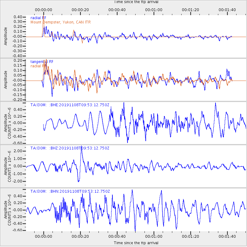
I30M Mount Dempster, Yukon, CAN - Earthquake Result Viewer
*The percent match for this event was below the threshold and hence no stack was calculated.
| Earthquake location: |
Samoa Islands Region |
| Earthquake latitude/longitude: |
-15.8/-172.6 |
| Earthquake time(UTC): |
2019/11/08 (312) 09:41:16 GMT |
| Earthquake Depth: |
80 km |
| Earthquake Magnitude: |
6.2 Mi |
| Earthquake Catalog/Contributor: |
NEIC PDE/pt |
|
| Network: |
TA USArray Transportable Network (new EarthScope stations) |
| Station: |
I30M Mount Dempster, Yukon, CAN |
| Lat/Lon: |
65.22 N/136.38 W |
| Elevation: |
1399 m |
|
| Distance: |
85.3 deg |
| Az: |
14.465 deg |
| Baz: |
214.8 deg |
| Ray Param: |
$rayparam |
*The percent match for this event was below the threshold and hence was not used in the summary stack. |
|
| Radial Match: |
73.81855 % |
| Radial Bump: |
400 |
| Transverse Match: |
62.61027 % |
| Transverse Bump: |
400 |
| SOD ConfigId: |
19951751 |
| Insert Time: |
2019-11-22 09:53:32.503 +0000 |
| GWidth: |
2.5 |
| Max Bumps: |
400 |
| Tol: |
0.001 |
|
Signal To Noise
| Channel | StoN | STA | LTA |
| TA:I30M: :BHZ:20191108T09:53:12.750Z | 2.379982 | 4.3828416E-7 | 1.841544E-7 |
| TA:I30M: :BHN:20191108T09:53:12.750Z | 0.9578875 | 7.440942E-8 | 7.7680745E-8 |
| TA:I30M: :BHE:20191108T09:53:12.750Z | 2.0200896 | 2.3164891E-7 | 1.1467258E-7 |
| Arrivals |
| Ps | |
| PpPs | |
| PsPs/PpSs | |


