PAS Pasadena, California, USA - Earthquake Result Viewer
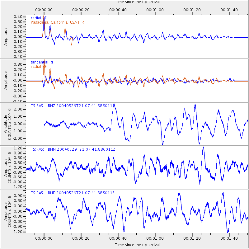
Earthquake location: Off East Coast Of Honshu, Japan
Earthquake latitude/longitude: 34.3/141.4
Earthquake time(UTC): 2004/05/29 (150) 20:56:09 GMT
Earthquake Depth: 16 km
Earthquake Magnitude: 5.6 MB, 6.6 MS, 6.5 MW, 6.3 MW
Earthquake Catalog/Contributor: WHDF/NEIC
Network: TS TERRAscope (Southern California Seismic Network)
Station: PAS Pasadena, California, USA
Lat/Lon: 34.15 N/118.17 W
Elevation: 295 m
Distance: 79.1 deg
Az: 56.158 deg
Baz: 303.944 deg
Ray Param: 0.04916814
Estimated Moho Depth: 27.25 km
Estimated Crust Vp/Vs: 1.73
Assumed Crust Vp: 6.1 km/s
Estimated Crust Vs: 3.526 km/s
Estimated Crust Poisson's Ratio: 0.25
Radial Match: 87.22539 %
Radial Bump: 400
Transverse Match: 75.44548 %
Transverse Bump: 400
SOD ConfigId: 2459
Insert Time: 2010-02-26 14:33:49.932 +0000
GWidth: 2.5
Max Bumps: 400
Tol: 0.001

Signal To Noise

ChannelStoNSTALTA
TS:PAS: :BHN:20040529T21:07:41.886011Z1.88868812.4678397E-71.3066422E-7
TS:PAS: :BHE:20040529T21:07:41.886011Z1.35058051.6326787E-71.2088718E-7
TS:PAS: :BHZ:20040529T21:07:41.886011Z2.3813635.272161E-72.2139258E-7
Arrivals
Ps3.3 SECOND
PpPs12 SECOND
PsPs/PpSs15 SECOND