You are here: Home > Network List > TA - USArray Transportable Network (new EarthScope stations) Stations List
> Station W17A Winslow, AZ, USA > Earthquake Result Viewer
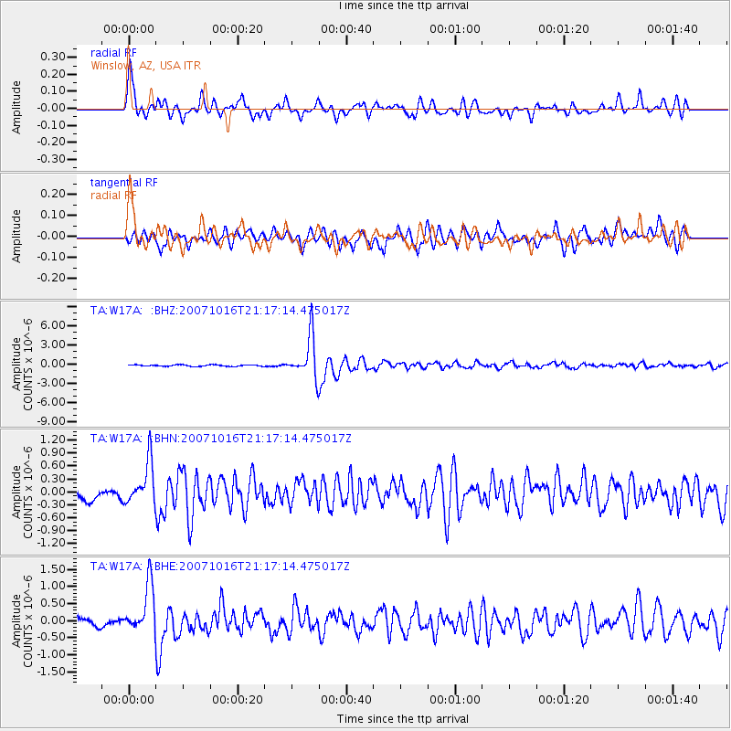
W17A Winslow, AZ, USA - Earthquake Result Viewer

| Earthquake location: |
South Of Fiji Islands |
| Earthquake latitude/longitude: |
-25.8/179.5 |
| Earthquake time(UTC): |
2007/10/16 (289) 21:05:43 GMT |
| Earthquake Depth: |
509 km |
| Earthquake Magnitude: |
6.2 MB, 6.6 MW, 6.5 MW |
| Earthquake Catalog/Contributor: |
WHDF/NEIC |
|
| Network: |
TA USArray Transportable Network (new EarthScope stations) |
| Station: |
W17A Winslow, AZ, USA |
| Lat/Lon: |
35.08 N/110.71 W |
| Elevation: |
1461 m |
|
| Distance: |
89.5 deg |
| Az: |
50.313 deg |
| Baz: |
237.778 deg |
| Ray Param: |
0.041605085 |
| Estimated Moho Depth: |
48.0 km |
| Estimated Crust Vp/Vs: |
1.69 |
| Assumed Crust Vp: |
6.207 km/s |
| Estimated Crust Vs: |
3.673 km/s |
| Estimated Crust Poisson's Ratio: |
0.23 |
|
| Radial Match: |
87.23931 % |
| Radial Bump: |
400 |
| Transverse Match: |
78.19093 % |
| Transverse Bump: |
400 |
| SOD ConfigId: |
2564 |
| Insert Time: |
2010-03-07 05:41:20.760 +0000 |
| GWidth: |
2.5 |
| Max Bumps: |
400 |
| Tol: |
0.001 |
|
Signal To Noise
| Channel | StoN | STA | LTA |
| TA:W17A: :BHN:20071016T21:17:14.475017Z | 3.3814757 | 5.062475E-7 | 1.49712E-7 |
| TA:W17A: :BHE:20071016T21:17:14.475017Z | 8.188318 | 7.418039E-7 | 9.059295E-8 |
| TA:W17A: :BHZ:20071016T21:17:14.475017Z | 28.351393 | 3.3586045E-6 | 1.18463475E-7 |
| Arrivals |
| Ps | 5.4 SECOND |
| PpPs | 20 SECOND |
| PsPs/PpSs | 26 SECOND |


