You are here: Home > Network List > US - United States National Seismic Network Stations List
> Station RLMT Red Lodge, Montana, USA > Earthquake Result Viewer
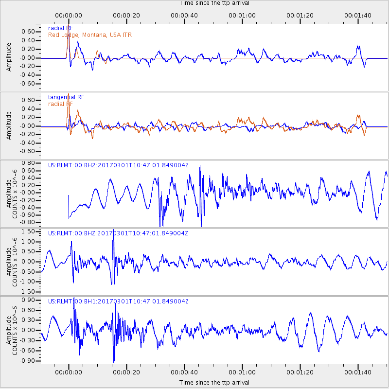
RLMT Red Lodge, Montana, USA - Earthquake Result Viewer
*The percent match for this event was below the threshold and hence no stack was calculated.
| Earthquake location: |
Andreanof Islands, Aleutian Is. |
| Earthquake latitude/longitude: |
52.2/-173.4 |
| Earthquake time(UTC): |
2017/03/01 (060) 10:39:49 GMT |
| Earthquake Depth: |
58 km |
| Earthquake Magnitude: |
5.5 mb |
| Earthquake Catalog/Contributor: |
NEIC PDE/us |
|
| Network: |
US United States National Seismic Network |
| Station: |
RLMT Red Lodge, Montana, USA |
| Lat/Lon: |
45.12 N/109.27 W |
| Elevation: |
2086 m |
|
| Distance: |
41.7 deg |
| Az: |
73.283 deg |
| Baz: |
303.58 deg |
| Ray Param: |
$rayparam |
*The percent match for this event was below the threshold and hence was not used in the summary stack. |
|
| Radial Match: |
73.951225 % |
| Radial Bump: |
400 |
| Transverse Match: |
61.542263 % |
| Transverse Bump: |
400 |
| SOD ConfigId: |
1992691 |
| Insert Time: |
2017-03-15 10:44:48.763 +0000 |
| GWidth: |
2.5 |
| Max Bumps: |
400 |
| Tol: |
0.001 |
|
Signal To Noise
| Channel | StoN | STA | LTA |
| US:RLMT:00:BHZ:20170301T10:47:01.849004Z | 1.1441025 | 4.1679306E-7 | 3.6429697E-7 |
| US:RLMT:00:BH1:20170301T10:47:01.849004Z | 1.7578096 | 3.4448678E-7 | 1.9597502E-7 |
| US:RLMT:00:BH2:20170301T10:47:01.849004Z | 1.658547 | 4.110537E-7 | 2.4783964E-7 |
| Arrivals |
| Ps | |
| PpPs | |
| PsPs/PpSs | |


